2017 Workshops! Registration is now open!

We are finally ready to announce our 2017 Workshops in North Carolina!

There has been a bit of a delay in getting the registration open but details and registration links were posted here yesterday: www.thatcadgirl.com/workshops.

PLEASE NOTE: This year’s workshops will have a bit more limited seating that previous years – Register Soon! to get your spot…


Carlson Workshop for Surveyors, Engineers & Contractors

11/7/2017 in Statesville NC

12/12/2017 in Raleigh NC

Topics include:

  • What’s new in Carlson 2018
  • Overview of staking and field to finish
  • Working with 2D and 3D PDFs to generate surface models
  • Overview of surface modeling, road design and sheet production
  • Importing Lidar data for use in presentations and surface modeling


In-Depth with Carlson Software

11/8/2017 in Statesville NC

12/13/2017 in Raleigh NC

Room 1) ​In-Depth ​Carlson ​Survey ​with ​Doug ​Aaberg

  • Field ​to ​Finish
  • ​Subdivision ​layout ​& ​design
  • Surface ​modeling ​and ​analysis

Room 2) ​In-Depth ​Civil, ​Hydrology ​& ​Precision ​3D ​with ​Mark ​Long

  • Advanced ​roadway ​design ​including ​profiles ​& ​cross-sections
  • ​Storm ​drainage ​design ​and ​detention ​pond ​design ​with ​multiple ​outlets ​using ​Carlson ​Hydrology
  • ​Presentations, ​surface ​modeling, ​watershed ​analysis ​and ​culvert ​design ​with ​Precision ​3D


IntelliCAD and Carlson Software – What are you waiting for?

Changes to Autodesk licensing and purchasing options seem to be coming like clockwork…  and those options are becoming more and more limited!

So, Is IntelliCAD (and Carlson Software) the Answer to Your Pain And Suffering…?

Join us for our FREE webinar on Wednesday June 28th to hear Dave Lorenzo, President of the IntelliCAD Technology Consortium (ITC), explain the history and the future of IntelliCAD as well as Dave Carlson, Exec VP of Carlson Software, to describe the relationship between Carlson Software and IntelliCAD and explain the reasons that Carlson delivers on IntelliCAD.

Lastly, I will spend a few minutes in the IntelliCAD software showing the similarities (and differences) between it and AutoCAD and the features I believe will be of most interest to civil/survey/construction software users.

See below for more information about IntelliCAD:

IntelliCAD is a cooperative CAD development platform that is becoming more and more accepted as an alternative to AutoCAD.

Feature-wise, IntelliCAD is closer to AutoCAD than to AutoCAD LT; just a couple generations older… but it’s catching up!

Click here to see all our Frequently Asked Questions about IntelliCAD


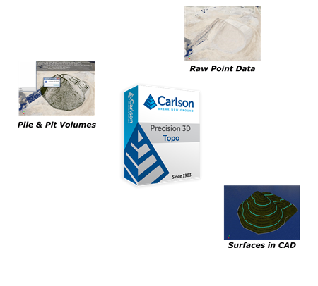
Precision 3D Topo – Attend June Webinars and Take Advantage of Introductory Pricing

Carlson Precision 3D Topo software is the hottest ticket in town!


Process raw point and cloud data…? Check!

Filter for bare ground data…? Check!

Export Carlson TIN or LandXML surface data…? Check!

Create, Edit and Merge Surfaces and Calculate Volumes on the fly…? Check!


Attend my Carlson software training seminars in June and take advantage of the introductory price of $1,100 for P3D Topo 2017 that includes a year of maintenance (updates) before the price goes up on July 14, 2017.

Or, request a custom proposal here

And, if you haven’t yet seen it in action, click here to register for one of these Tuesday webinars:

  • Tuesday June 13 at 2:30 ET
  • Tuesday June 20 at 2:30 ET

Or click one of the links below to register for a Friday webinar:

See below for a link to videos and additional descriptions and specs of the product…

Recording of Precision 3D 2017 Topo: Surface Editing 1

Other Precision 3D Topo Videos

Carlson Software Training Seminars

Carlson Precision 3D Topo: Allows Civil Engineers, Surveyors, and Contractors to bridge the gap between large point cloud data sets created from Drone and Lidar data into a more manageable data to use in today’s CAD environments.

Carlson Precision 3D Topo: A Windows OS software application to enable Engineers and Surveyors to create surface models (TIN”S or LandXML) using Drone and Lidar Data from the following file formats .las, .laz, .ply, .xyz, .pts, .e57, .pcd files

Carlson Precision 3D Topo: Main Features

  • Import point clouds from .las, .laz, .ply, .xyz, .pts, .e57, .pcd files
  • Bareground classification and Outlier filter for .las, laz files
  • Supports mixed Metric/Imperial units
  • Supports georeferenced data import/export
  • Fast Point Cloud Editing
  • Creating TIN’s and XMLfiles of large point clouds
  • Surface Model Creation, Editing, and Merging
  • Volume Calculation straight from Point Clouds
  • Presentations and Visualizations
  • Drag and Drop File Support
  • Machine Control Data Review and Edits


How to Control Object- and File-Linking in Carlson Software

I just received an email with a common Carlson Software support question and figured it’s high-time to write a post about it!

The question was:

Do you know if there is a way to annotate a bearing/distance on a line so that the call will update if I move the line?

The answer is: Yes, I do and Yes there is!

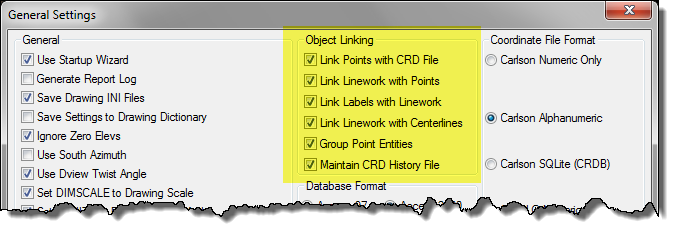
While a lot of people want the control object and file linking in Carlson Software to be an automatic feature, Carlson Software gives you the option of having entities in a DWG file associated and “linked” with external data files. The specific scenario mentioned above, annotation of lines, is managed with the Object Linking settings under Settings > Carlson Configure > General Settings. The option he needed to turn On was “Link Labels with Linework”.


Similarly, when we’re working on larger design projects such as a road design that has associated data files such as centerlines, profiles, surfaces and pipe networks, we need to have control over which, if any, part(s) of the design automatically update when one part of the design changes.

For instance, if the proposed profile of a new road changes, do we want the proposed surface to automatically update? Or update only when we manually force the design changes through the rest of the project? Or do we want to be reminded and prompted that there are dependencies “downstream” in the design that are being affected by the change? Likewise, do we want rim elevations of manholes to automatically update if a centerline or surface changes?

At every stage of design, file linking in Carlson Software gives users a setting to “Link” or associate to files that can be set to “Off” (requires the user to click “Process”), “Prompt” (displays a warning box prompting the user to apply or ignore changes) or “Auto” (automatically processes updates).

Some examples are shown below:


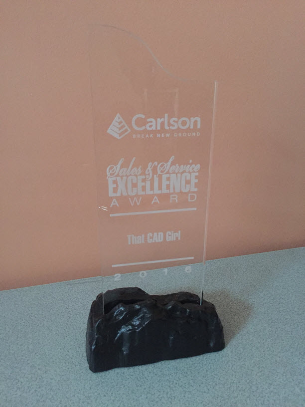
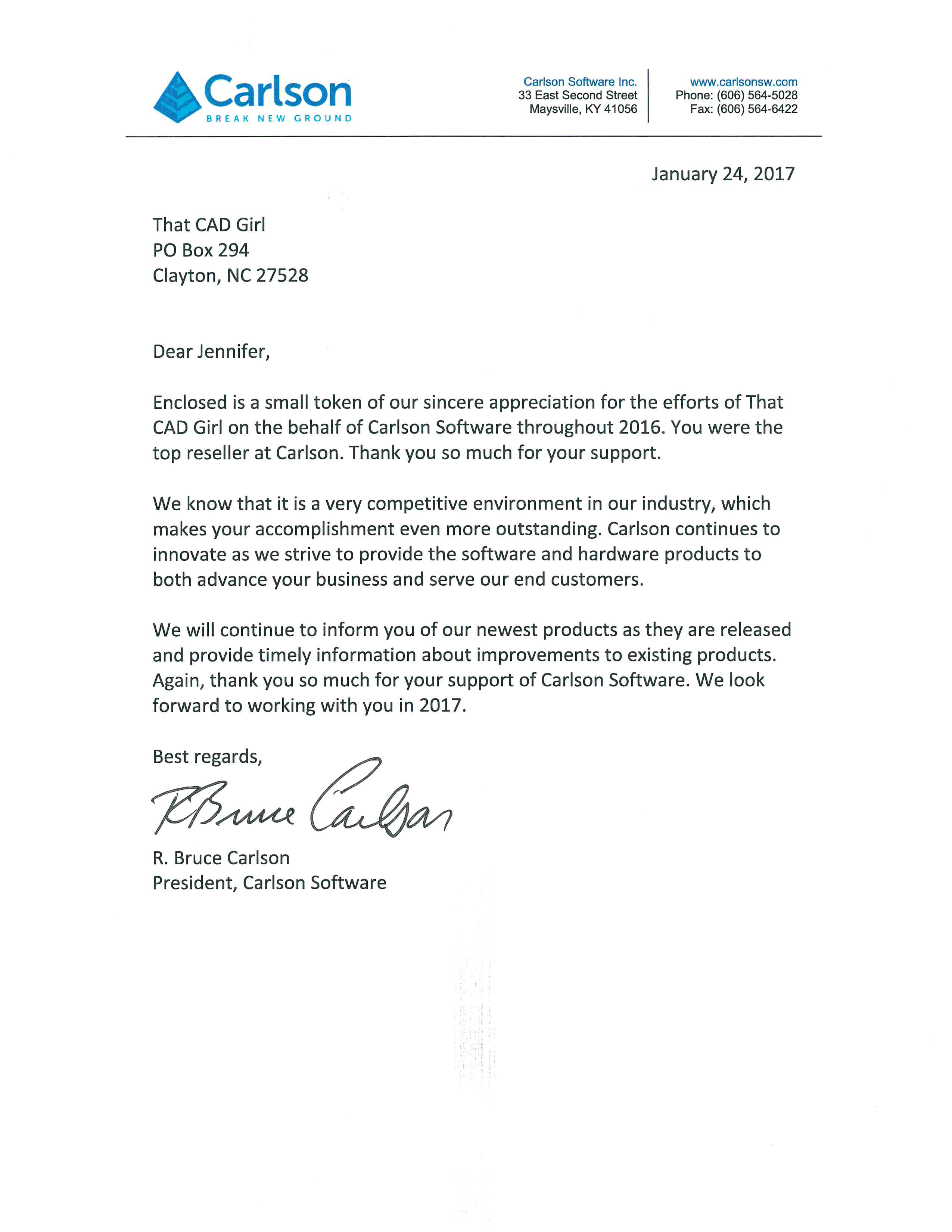
That CAD Girl – Top Reseller for Carlson in 2016!!

I received this award and letter over the weekend but just had a chance to put it all together in a post…

This is the 7th year in a row that That CAD Girl has been the top reseller for Carlson Software but the first time I’ve received an award or anything “official”. What a nice surprise!

As much as I appreciate the recognition I need to turn it around and thank the mighty-band of loyal customers, far and wide, who have helped grow this business. If it wasn’t for your referrals and requests for conference speaking engagements, etc, it wouldn’t have gone anywhere.

Jeremy Taylor, “That CAD Guy”, has definitely helped grow the hardware side of the business (by a LOT!) and been a fantastic resource for both me and our customers. I think you’ll be seeing more of him teaching classes because he’s awfully good at it…

I also want to thank the rest of the “Workshop Crew” shown below: Butch Herter, Dean Goodman, Scott Griffin, Mike Jones, Mark Long and Jeremy.

It’s an exhausting but fun few weeks each November and December and they continue to step up with their support and service. Lee Guerringue is the only one not in the pictures (she’s usually behind the camera) but has contributed our “Greatest Hits” and much more.

Thanks to everyone and here’s to an even better 2017!


What Webinars Are On Tap for March & April?

What’s coming up?

  • Intro to Carlson Software – Settings, Setup, Configuration & Points
  • Standardizing Linetypes & Dimension Styles in CAD
  • Overview of Cut Sheets in Carlson
  • The Very Basics of Field to Finish
  • 3D Site Grading Tips & Tricks
  • GIS Data Collection for Surveyors by Jeremy Taylor, PLS
  • Carlson GIS for Surveyors
  • Drafting Pipes & Structures in Carlson Hydrology
  • Perfecting Linework with Carlson Field to Finish

Preregister: http://thatcadgirl.com.betasites.soundst.com/contact-us/#webinarinfo

Learn more: http://thatcadgirl.com.betasites.soundst.com/faq/can-i-attend-your-webinars-for-free/


Register Today for a Free Webinar by the developers of the US National CAD Standard® (NCS)

Industry professionals interested in learning how to use layers in the nation’s leading CAD standard should attend the upcoming webinar hosted by the developers of the United States National CAD Standard® (NCS)

This upcoming free, webinar, “CAD Layers: Why Do We Need Them?” will be held Thursday, February 9, 2017, from 2:00 – 3:00 pm ET.

The webinar will include a question and answer segment. Attendees can submit their specific questions upon registering for the event. They do not need to own the NCS to attend.

Read more and register for this webinar at this link: https://www.nibs.org/events/EventDetails.aspx?id=926329


More Webinars for Surveyors in January & February!

We’ve added a couple more webinars to our January and February 2017 offerings…

On Tuesday January 10th you can join Jeremy Taylor for Traverse Adjustment with Carlson Survey and, on February 16th, he will be presenting Beyond Field to Finish – How to get the most out of SurvCE or SurvPC with Carlson Survey for the first time in webinar format. (See below for details about this webinar).

12-Months of access to our webinars are available for purchase here at a discount through 12/31 but the webinars are included for FREE if you purchase your software through That CAD Girl.

Click here to see the full list of upcoming webinars

Click here to view our special end-of-year discounts on Carlson Software

Pre-Register here for all webinars


Survey   Carlson SurvPC   Carlson SurvCE


Beyond Field to Finish – How to get the most out of SurvCE or SurvPC with Carlson Survey by Jeremy Taylor PLS

If you’re using Carlson Survey in the office and SurvCE or SurvPC in the field, join us for this webinar to learn some tips & tricks to get the most out of your software.

Some of the items that may be included are:
– Collecting photo / attribute data “GIS” style in a conventional location survey,
– Using Carlson Cloud to transfer data from office to field to office
– Field stakeout with simple horizontal and vertical alignments
– Generating basis cut sheets with using field and office data

This webinar will last 1-2 hours and there will be time for questions at the end.


More End of Year Specials from That CAD Girl & That CAD Guy

In addition to the regular year-end specials offered by Carlson, Jeremy and I have decided to offer a few of our own… We are limited as to the pricing we’re allowed to show so please click here to Request a Custom Proposal.

Solo Surveyor Bundle
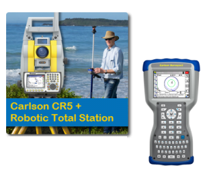
Bundle includes CR5+, Surveyor2 Standard plus accessories

Need more? We have great discounts on the CR5+ by itself or can customize a package with different models of the robot or data collector, add modules to SurvCE or add desktop software such as Carlson Survey or Civil Suite.

Request pricing here and financing options ARE available.


SuperSweetSuite2_nopricing

How About a
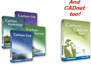
Super Sweet Suite?

That CAD Girl’s exclusive offer of the programs of the Civil Suite and CADnet!

Request pricing here


WebinarsAd_995_forgallery_$300 Off Webinars

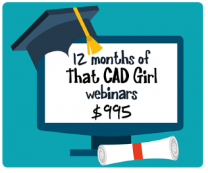
If you’ve purchased software through That CAD Girl, you’re all set – webinars are included with every new purchase!

But, if you purchased elsewhere… uh-oh… you can still purchase a year’s access here.

Read more about our webinars here or click here to review one of our recent webinars to see what it’s like.


Lessons01a02a02b_CoverImage-1024x980

$50 Off
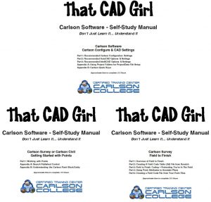
Self-Study Bundle of Manuals

These manuals were written a few releases ago but still hold up pretty well!

Whether you’re fluent in CAD and only trying to learn Carlson or you’ve never used AutoCAD or IntelliCAD before, you’ll be able to work through these manuals easily!

Click here and check out “What’s Inside” for sample pages – there is a picture/graphic for almost every step!


Last call! Raleigh Workshops are next week!


Tuesday is our Workshop for Carlson Surveyor and we have Dean Goodman (formerly of C & G Software) presenting an intensive 1/2-day of training on SurvNet Least Squares. Jeremy, Scott & I will be presenting other sessions on traverse adjustment, field to finish, stakeout tips & annotation.
 
Mark Long has our highlighted sessions on Wednesday in the Workshop for Engineers & Designers. Mark’s sessions are free-flowing and interactive – he will be covering techniques in advanced roadway design in the morning and advanced hydrology in the afternoon. While Mark keeps everyone entertained in one room, the rest of us will be demonstrating various software tools for grading and design in Carlson Surveyor Software.
 
And, rumored but not confirmed… we may have another guest presenter showing up on Wednesday to demonstrate the latest in Carlson’s Precision 3d products. Anyone who attended the first few workshops almost 10 years ago may know who I’m talking about!
NC licensed surveyors and engineers will receive 8 PDH credits per day. As always, the lunch will be grand and the giveaways spectacular!
 
Follow this link to learn more and register now! http://thatcadgirl.com.betasites.soundst.com/classroom-and-conferences/
 
Enjoy the pics below from the workshops in Hendersonville and Statesville last month…


1 of 1