FAQ
Faq category: Buying Guide
That CAD Girl Active Coupon Codes (a running thread)
+Black Friday Discount
Discount to add Survey, Civil, Hydrology, GIS, CADnet or Point Cloud Basic to any current license
(regular price $750)
Email ContactUs@thatcadgirl.com for custom proposal
Black Friday Discount
Coupon automatically applied at checkout after adding select Carlson Software to your cart
$500 off
Takeoff Suite and Maintenance
After adding Takeoff Suite and Maintenance to your cart, select the coupon Takeoff Suite at checkout for an additional discount.
This offer will end on 1/24/2023
$500 off
Takeoff OEM
After adding Takeoff OEM to your cart, select the coupon Takeoff OEM at checkout for an additional discount.
This offer will end on 1/24/2023
Free Carlson Takeoff Training
With the purchase of any new license of Carlson Takeoff Suite or Takeoff OEM, you will have the option of adding a registration to our January 2023 Fast Track to Carlson Takeoff training to your cart.
At checkout, click on the coupon Free Takeoff Training to apply a coupon for 100% off the registration price.
That CAD Girl Standard Discount
Coupon automatically available at checkout after adding select Carlson Software products to your cart
That CAD Girl Online Store Pricing
After adding select Carlson Software products to your cart, use Coupon Code tcgonlinestore at checkout for additional discounts
$2,300 for Pick 2 and Maintenance
After adding Select Suite Pick 2 to your cart, select the coupon Pick 2 Special at checkout for an additional discount.
This offer will end on 4/2/2023
Extra $100 Off
After adding Select Suite Pick 3 to cart, a coupon for an extra $100 off will be available
Available through 12/31/2021
That CAD Girl Maintenance Discount
After adding select Carlson Software AND maintenance to cart, use Coupon Code tcgmaintenance at checkout for additional discount. Currently available for Carlson Survey, Civil, Civil Suite, Pick 2 and Pick 4
Black Friday Discount
Coupon automatically applied at checkout after adding Carlson Takeoff Suite to your cart
Discount Workshop Registration
With the purchase of any new license of Carlson Software, you will have the option of adding 2022 Virtual Workshop Registration to your cart.
At checkout, click on the coupon 2022 Virtual Workshop to apply a coupon for $100 off the registration price.
Free Maintenance
When adding select Carlson Software to your cart, you will have the option of adding 1-Year of Free Maintenance to your cart.
No Coupon Code is required for this discount.
Ends 12/31
EXTRA $500 off
After adding Civil Suite or Select Suite Pick 4 to your cart, use Coupon Code dogdays2022 at checkout for additional discount.
This offer will end on 9/1/2022
Extra $100 Off
After adding Select Suite Pick 6 to cart, a coupon for an extra $100 off will be available
Available through 12/31/2021
End of Year Discount
Coupon available at checkout after adding Carlson Takeoff Suite to your cart
Expires 12/31/2021
Extra $100 Off
After adding select Carlson Software AND maintenance to cart, use Coupon Code extra100 at checkout for additional $100 discount.
Currently available for Carlson Civil Suite, Pick 3 and Pick 4
Free Maintenance
When adding select Carlson Software to your cart, you will have the option of adding 1-Year of Free Maintenance to your cart.
No Coupon Code is required for this discount.
Expires 12/31/2022
Extra $100 Off
After adding Select Suite Pick 5 to cart, a coupon for an extra $100 off will be available
Available through 12/31/2021
End of Year Discount
Coupon available at checkout after adding select Carlson Software to your cart
Expires 12/31/2021
Black Friday Discount
Coupon automatically applied at checkout after adding select Carlson Software to your cart
That CAD Girl Manuals
$50 discount coupon will be automatically available at checkout after adding any new license of Carlson Software and That CAD Girl Self-Study Training Manuals to your cart
Extra $250 Off
After adding select Carlson Software AND maintenance to cart, use Coupon Code extra250 at checkout for additional $250 discount.
Currently available for Carlson Takeoff Suite.
That CAD Girl Maintenance Discount
After adding select Carlson Software AND maintenance to cart, use Coupon Code “tcgmaintenance” at checkout for additional discount
That CAD Girl P3D Hydro & Topo
After adding Carlson P3D Hydro & Topo to your cart, use Coupon Code tcgp3dextra at checkout for additional discounts
That CAD Girl Preferred Pricing
After adding select Carlson Software products to your cart, use Coupon Code “tcg preferred” at checkout for additional discounts
P3D? or Point Cloud? then Point Cloud Basic? or Point Cloud Advanced?
+Here is a handy chart – current as of the 2023 product release: Comparison: Point Cloud Basic vs Point Cloud Advanced
View Carlson Point Cloud webinars
From the 2019 post:
I don’t know about you but the new Carlson product offerings for P3D Topo and Point Cloud Basic and Point Cloud Advanced confuse me. Admittedly, these are products I haven’t dived into much and have relied on Mark Long and Doug Aaberg for their advice and direction. So, I put the question to them, “Who Needs Point Cloud? And Who Needs P3D Topo?”
Doug Aaberg: I feel that while Carlson P3D topo is a good solution for producing, manipulating surface models as well as some hydrology capabilities while Carlson Point Cloud is a good solution for performing virtual surveys and extracting existing data out of a cloud. It is probably to simple to surmise by saying Engineers would like P3D while Surveyors would like Point Cloud but I sort of think that way. The truth is, there is a lot of overlap between the two products.
Mark Long says: Carlson P3D Topo is intended to take large point clouds and create surface models for design professionals via Drones or Lidar.
And as to the difference between Point Cloud Basic and Advanced? Doug says: Point Cloud Basic – designed to work within a CAD environment to manipulate and extract data from a point cloud. It has a very large capacity (up to a billion points) and is a great program for performing a “virtual survey” directly in a cloud. It allows the creation of Carlson points and 3D polylines utilizing a typical Carlson Field to Finish code table (FLD file) and draws entities directly into an open CAD drawing with no additional export function. A notable feature is Survey by Grid which sets points at any specified grid spacing.
Point Cloud Advanced – contains all of the functionality of Carlson Point Cloud Basic plus the ability to extract features such as trees, hydrants and poles. It also allows the creation of solids and utilizes typical Carlson cross section alignments (mxs files) to extract cross sections and profiles. You can select cloud data by color or elevation and create regions for isolating portions of a cloud for editing or extracting features.. A notable feature is the ability to simplify a TIN and create smoother looking contour lines.
My Maintenance is Current… Where’s My Upgrade?
+With the building out of your That CAD Girl Customer Portal, we are doing our best to have all the information you need about your serial numbers easily accessible and available to you.
As soon as possible after a new release, we will post your new, upgraded serial number(s) to your Customer Portal and will upload a new maintenance report showing your new serial number(s). However, if you get to this before we do… you can use the Carlson Software Serial Number Upgrade Lookup site to get your new serial number as soon as it’s released.
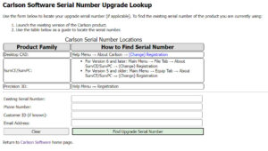
You will need the items listed below. Your serial number and Carlson Customer ID can be found on your That CAD Girl Customer Portal:
- Your current serial number
- Your Carlson Customer ID
- Phone Number
- Email Address
Does Carlson Software Still Offer Perpetual Licenses?
+The change from a perpetual license model (you purchase once and continue to use it forever) to a subscription license model (you pay by the month or by the year for access) in our little CAD corner of the world has sparked a lot of questions, debate and heartburn.
In 2015 Autodesk announced they would be shifting toward a subscription model of delivery for their AutoCAD-based products. Although some Autodesk accounts and products were grandfathered in, any new purchases of AutoCAD are now available by subscription only. And, the kicker, you stop paying, you can’t access the software or your data.
Carlson Software remains committed to the perpetual license model where you, the user, never have to worry about losing access to your software or data. Carlson’s desktop software includes a license of IntelliCAD so, if you ever stop paying for your AutoCAD, Carlson with IntelliCAD can give you another option to open your DWG files. If you want to ensure you have “perpetual” access to all your other data such as points, surfaces, road designs and more – make sure you archive your project data to Land XML files so that it can be retrieved with other land development, survey, civil and construction software programs.
See also: How can I access and use my old Civil 3d, Land Desktop, Eagle Point or Terra Model data?
See also: Get a Perpetual License with Carlson or download PDF
See also: Robert Green’s CAD Manager’s Newsletter #350 Autodesk Goes Subscription-Only in 2016 or download PDF
See also: Autodesk Courtesy Notice: End of Perpetual Licenses Sales, including individual products and suites
What’s the difference between Carlson with IntelliCAD and with the embedded AutoCAD (OEM) platform?
+Whether you’re using Carlson Survey or Takeoff on the IntelliCAD or embedded AutoCAD (OEM) platform, the Survey and Takeoff functionality will be identical. Any differences are going to be strictly limited to the underlying engine – IntelliCAD or embedded AutoCAD.
- From a feature and functionality standpoint, IntelliCAD will be closer to a full AutoCAD and embedded AutoCAD (OEM) will be closer to an AutoCAD LT.
- IntelliCAD is generic version of AutoCAD and tracks closer to a 4-5 year old version of AutoCAD. See this FAQ comparing IntelliCAD and AutoCAD
- Embedded AutoCAD (OEM) will look more like today’s AutoCAD and may have more of the current bells and whistles – but it’ll also be missing some key functionality such as the ability to create aliases (command shortcuts) and load LISP routines. See this FAQ comparing embedded AutoCAD (OEM) and AutoCAD
It’s a work in progress but you can check out this FAQ where I’m starting a list of the differences between the two programs.
What features & menus are in Carlson Point Cloud? (a running thread)
+Carlson Point Cloud 2019 - Basic and Advanced

Features and Benefits of Point Cloud 2019
Comparison: Point Cloud Basic vs Point Cloud Advanced
Commands in Point Cloud Basic and Point Cloud Advanced
View product page for Point Cloud Basic
View product page for Point Cloud Advanced
Carlson Point Cloud is a modular program that provides this powerful ability to go from field scan to finished plat, all with seamless integration to Carlson Survey, Carlson Civil and Carlson Mining. Carlson Point Cloud delivers a whole new level of powerful automation for large data sets. It gives laser scanner users the ability to process millions of data points with Carlson Software ease-of-use.
Register your scan to local coordinates, filter or decimate the points, overlay raster images in 3D, snap to edges and code the descriptions for automated field-to finish processing of linework and symbols and create contours, profiles, sections, and breaklines. You will be able to read scan data from many instruments, view and process up to 1 billion points, and then perform the Field-to-Finish from the scanned data!
This Carlson Software office product allows users to export surface models, points, contours, breaklines, grid and profiles to CAD.
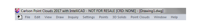
Carlson Point Cloud 2017
Features and Benefits of Point Cloud 2017
Register your scan to local coordinates, filter or decimate the points, overlay raster images in 3D, snap to edges and code the descriptions for automated field-to finish processing of linework and symbols and create contours, profiles, sections, and breaklines. You will be able to read scan data from many instruments, view and process up to 1 billion points, and then perform the Field-to-Finish from the scanned data!
This Carlson Software office product allows users to export surface models, points, contours, breaklines, grid and profiles to CAD.
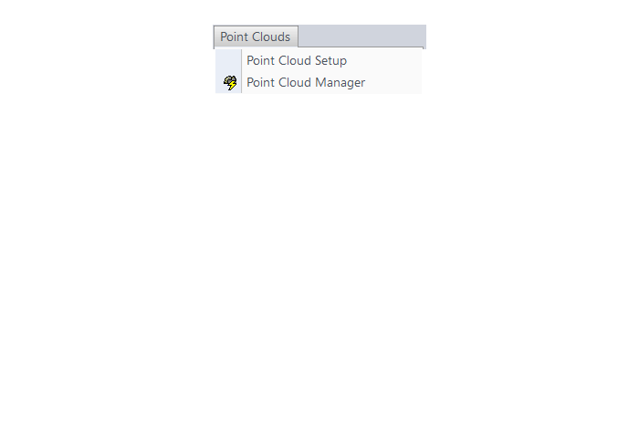
Menus in Point Cloud 2017
Menu Bar in Point Cloud 2017
The menus below are available in Carlson Point Cloud 2017
Point Clouds Menu
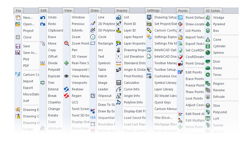
The menus below are in all non-OEM programs of Carlson 2017 desktop software
(Click image to see more)
Is it better to network Carlson than use standalone licenses?
+The only time I’d recommend networking individual licenses such as Survey, Survey OEM, Civil, etc. is if you have 2 or more people who can literally share a license. For instance, if you have a technician who works in one office or on one computer from 8-12 and another who works in a different office or computer from 1-5 then, yes, network away!
Using this example, only one license will ever be in use at any one time so you would only need to buy one networked license that can be shared on multiple computers.
Networking one or more licenses of individual seats can also be beneficial if you have several people using the software part-time. Maybe you buy 3 licenses for 4 to share because only 3 people will ever be using it at the same time.
All that being said, networking one of Carlson’s Suites (Civil or Takeoff) can potentially save a lot of money. Civil Suite includes 4 programs: Survey, Civil, Hydrology and GIS. Takeoff Suite includes 4 as well: Construction, CADNet, GeoTech and Trench. If you network either of the Suites, each of those programs acts like an individual license. Sweet Suite!
So, if you buy one standalone license of Civil Suite, that license is registered to one user who can access any of the 4 programs at will. But, if you network that Civil Suite, you can have one person working in Survey at the same time someone else is working in Civil, while a 3rd person is working in Hydrology and a 4th is in GIS.
Even though this sounds like a great way to save money, you should also be aware that sharing licenses can also become a headache to your staff and lead to some loss in productivity. It’s like anything else, networking the Suites has its pros and cons.
You may also want to refer to this updated FAQ: Working with Carlson’s network license manager for more information.
What you should know about purchasing Carlson Software
+
Carlson Platform Options
Carlson Software’s desktop programs can be installed as a standalone program on top of IntelliCAD or on top of your separately purchased, full-AutoCAD-based program.
Carlson includes the latest version of IntelliCAD with every purchase.
The full-AutoCAD-based program can be AutoCAD, AutoCAD Map, Land Desktop, Civil 3D or other vertical – but does NOT include AutoCAD LT.
Carlson Survey and Takeoff can also be purchased and installed standalone with embedded AutoCAD (also known as the OEM version).
The embedded AutoCAD (OEM) programs include a limited, stripped-down version of AutoCAD that has functionality similar to AutoCAD LT.
The embedded AutoCAD (OEM) programs do not include IntelliCAD and do not require a separate purchase of AutoCAD.
The embedded AutoCAD (OEM) programs are a completely separate install than the programs that run with IntelliCAD or separately purchased license of full-AutoCAD and, although both programs can be installed on the same computer, the programs cannot be “combined”. For instance, if you own a license Survey OEM and also a license of Carlson GIS with IntelliCAD and need to access commands in both programs for work on a single drawing (.dwg) file, you would have to close the drawing out of the Survey OEM and then open it in the GIS program to do the work there.
Retail Pricing for Carlson Software
| Program | Retail Price of Standalone | Retail Price of Network | That CAD Girl Pricing |
|---|---|---|---|
| Select Suite - Pick 6 (from Survey, Civil, Hydrology, GIS, Point Cloud Basic, CadNet) | $ 4,750 | $ 5,225 | * See in store |
| Select Suite - Pick 5 (from Survey, Civil, Hydrology, GIS, Point Cloud Basic, CadNet) | $ 4,350 | $ 4,785 | * See in store |
| Civil Suite or Select Suite Pick 4 (from Survey, Civil, Hydrology, GIS, Point Cloud Basic, CadNet) | $ 3,950 | $ 4,345 | * See in store |
| Select Suite - Pick 3 (from Survey, Civil, Hydrology, GIS, Point Cloud Basic, CadNet) | $ 3,550 | $ 3,905 | * See in store |
| Select Suite - Pick 2 (from Survey, Civil, Hydrology, GIS, Point Cloud Basic, CadNet) | $ 2,950 | $ 3,135 | * See in store |
| Survey | $ 1,950 | $ 2,145 | * See in store |
| Civil | $ 1,750 | $ 1,925 | * See in store |
| Hydrology | $ 1,250 | $ 1,375 | * See in store |
| GIS | $ 1,095 | $ 1,205 | * See in store |
| Takeoff Suite (Construction, CADNet, Trench, GeoTech) | $ 7,500 | $ 8,250 | * See in store |
| Construction | $ 3,750 | $ 4,125 | * See in store |
| CADNet | $ 1,595 | $ 1,755 | * See in store |
| Trench | $ 1,595 | $ 1,755 | * See in store |
| GeoTech | $ 1,595 | $ 1,755 | * See in store |
| Takeoff with embedded AutoCAD (OEM) | $ 9,000 | $ 9,900 | * See in store |
| Survey with embedded AutoCAD (OEM) | $ 2,995 | $ 3,295 | * See in store |
| Other Software or Hardware | Request Pricing or *See in store |
Carlson Software Annual Maintenance
If it is renewed prior to expiration, maintenance costs 10% of the retail price of the software. See Upgrading Carlson Software below for more information about renewals after maintenance has expired.
Carlson’s Annual Maintenance is NOT available for embedded AutoCAD (OEM) products, for SurvCE or for SurvPC. It is only available for IntelliCAD/for CAD-based products.
Carlson’s policy on Software Maintenance can be viewed by clicking here.
| Program | Retail Price of Standalone | Annual Maintenance for Standalone | Retail Price of Network | Annual Maintenance for Network |
|---|---|---|---|---|
| Select Suite Pick 6 | $ 4,750 | $ 475 | $ 5,225 | $ 522.50 |
| Select Suite Pick 5 | $ 4,350 | $ 435 | $ 4,785 | $ 478.50 |
| Select Suite Pick 4 | $ 3,950 | $ 395 | $ 4,345 | $ 434.50 |
| Select Suite Pick 3 | $ 3,550 | $ 355 | $ 3,905 | $ 390.50 |
| Select Suite Pick 2 | $ 2,750 | $ 275 | $ 3,025 | $ 302.50 |
| Civil Suite | $ 3,950 | $ 395 | $ 4,345 | $ 434.50 |
| Survey | $ 1,950 | $ 195 | $ 2,145 | $ 214.50 |
| Civil | $ 1,750 | $ 175 | $ 1,925 | $ 192.50 |
| Hydrology | $ 1,250 | $ 125 | $ 1,375 | $ 137.50 |
| GIS | $ 1,095 | $ 109.50 | $ 1,205 | $ 120.50 |
| Takeoff Suite | $ 7,500 | $ 750 | $ 8,250 | $ 825.00 |
| Construction | $ 3,750 | $ 375 | $ 4,125 | $ 412.50 |
| CADNet | $ 1,595 | $ 159.50 | $ 1,755 | $ 175.45 |
| Trench | $ 1,595 | $ 159.50 | $ 1,755 | $ 175.50 |
| GeoTech | $ 1,595 | $ 159.50 | $ 1,755 | $ 175.50 |
Upgrading Carlson Software
Upgrading Carlson’s non-OEM desktop products is done through the Maintenance Plan.
If it is renewed prior to expiration, maintenance costs 10% of the retail price of the software. If Maintenance is not renewed prior to expiration, a 1-year Maintenance Plan costs 15% of software list price and increases by 5% per year after the expiration date.
If your license is not currently on maintenance, you can pay the maintenance fee plus an expiration fee which will both upgrade you to the current version of the program AND include any upgrades that are released within the maintenance year.
| Maintenance Status | Annual Maintenance (Percentage of Retail) | Expiration Fee (Percentage of Retail) | Total Fee (Percentage of Retail) |
|---|---|---|---|
| Current | 10% | 0 | 10% |
| 1 year behind | 10% | 10% | 15% |
| 2 years behind | 10% | 20% | 20% |
| 3 years behind | 10% | 30% | 25% |
| 4 or more years behind | 10% | 40% | 50% |
Sample Upgrade & Maintenance Renewal Pricing
| Program | # of Years Expired | Retail Price | Total Fee (Percentage of Retail) | Total Fee to Upgrade and/or Renew Maintenance for 1 Year |
|---|---|---|---|---|
| Survey | 0 maintenance is current | $ 1,850 | 10% | $ 185.00 |
| Survey | Less than 1 maintenance has expired | $ 1,850 | 20% | $ 370.00 |
| Networked Survey | Less than 1 maintenance has expired | $ 2,035 | 20% | $ 407.00 |
| Civil Suite or Select Suite Pick 4 | 0 maintenance is current | $ 3,950 | 10% | $ 395.00 |
| Civil Suite or Select Suite Pick 4 | Less than 1 maintenance has expired | $ 3,950 | 20% | $ 790.00 |
| Networked Civil Suite or Select Suite Pick 4 | Less than 1 maintenance has expired | $ 4,345 | 20% | $ 869.00 |
The cost to upgrade Carlson’s OEM products varies depending on the program and how many versions behind you are.
Follow this link then click on Request a Custom Proposal to request upgrade pricing.
Competitive Upgrades
Follow this link then click on Request a Custom Proposal to see if additional discounts are available.
System Requirements for Desktop Software
Because it changes from version to version, my “go-to” answer is going to always point to this page where Carlson lists the minimum system requirements for running Carlson with embedded AutoCAD (OEM), on top of AutoCAD and with IntelliCAD.
You may also keep an eye on our System Requirements and Hardware Compatibility FAQs for the latest information.
30 Day Trials
Then click on Request a 30 day Trial Serial Number
Once you decide to purchase, you won’t even need to uninstall. You can activate your software by simply updating your registration with your purchased serial number.
Technical Support & Training
You can see all the opportunities for training with That CAD Girl here and you can follow these links for to see our FAQs about the training and technical support available from Carlson and That CAD Girl.
What are the system requirements to run Carlson Software in the office? Do I need a monster computer?
+But, Carlson’s core product and IntelliCAD can run on pretty light-duty machines.
The minimum system requirements for running Carlson with embedded AutoCAD (OEM), on top of AutoCAD and with IntelliCAD are posted here.
Updated for 2020: Carlson 2020 software will no longer run on 32 bit machines.
Note: If you are using an Nvidia video card, you will want to make sure you get the driver and updates directly from Nvidia.com and not just let Windows search for updates.
See also: Carlson KB1123: Changing graphics card settings to use your dedicated GPU on a Windows computer
See also: Carlson KB1131: NVidia video card: visual artifacts, pixelized lines, wrong text display
What should I buy if I need a basic CAD program (like AutoCAD LT)?
+In September, Carlson Software introduced a new program in their lineup: Carlson iCAD. This program is comparable to AutoCAD LT with basic drafting and inquiry tools but is built on IntelliCAD 8.3.
FAQ: What features are in Carlson iCAD? (a running thread)
View Carlson iCAD in our online store
If you truly, truly only need generic-CAD functionality, I recommend purchasing Carlson GIS with IntelliCAD. It’s the cheapest of all the desktop products and you can load this basic IntelliCAD menu:

What features & menus are in ALL Carlson, non-OEM, desktop software programs? (a running thread)
+Carlson 2017
Features and Benefits of all Carlson desktop programs
- Work natively in DWG format files – whether using the IntelliCAD or AutoCAD platform,
- Import DGN, DXF, DWF files,
- Import and Export LandXML/RoadXML files,
- Export Google Earth KML/KMZ files,
- Export files to be used in GPS guided machine control systems,
- Export DTM, Google, Idan, Microstation, MOSS, Peabody, Topcon, and 12D polyline files
- Customize project folders and sub-folders to organize your project data,
- Incorporate your own CAD Standards Tools into basic drafting functions,
Import, export and convert points using text or most any other format including Civil 3d, - Access to the entirety of the Carlson software File, Edit, View, Draw, Inquiry, Settings, Points and 3D Solids menus including these popular commands:
- Drawing cleanup
- 2d and 3d polyline editing commands to reverse polylines, add/remove segments or vertices, etc.
- Shrinkwrap entities
- Boundary polyline
- Erase and Copy by layer
- 3d Viewer Window
- Surface 3d Viewer
- Search Published Control – an Esri-powered command
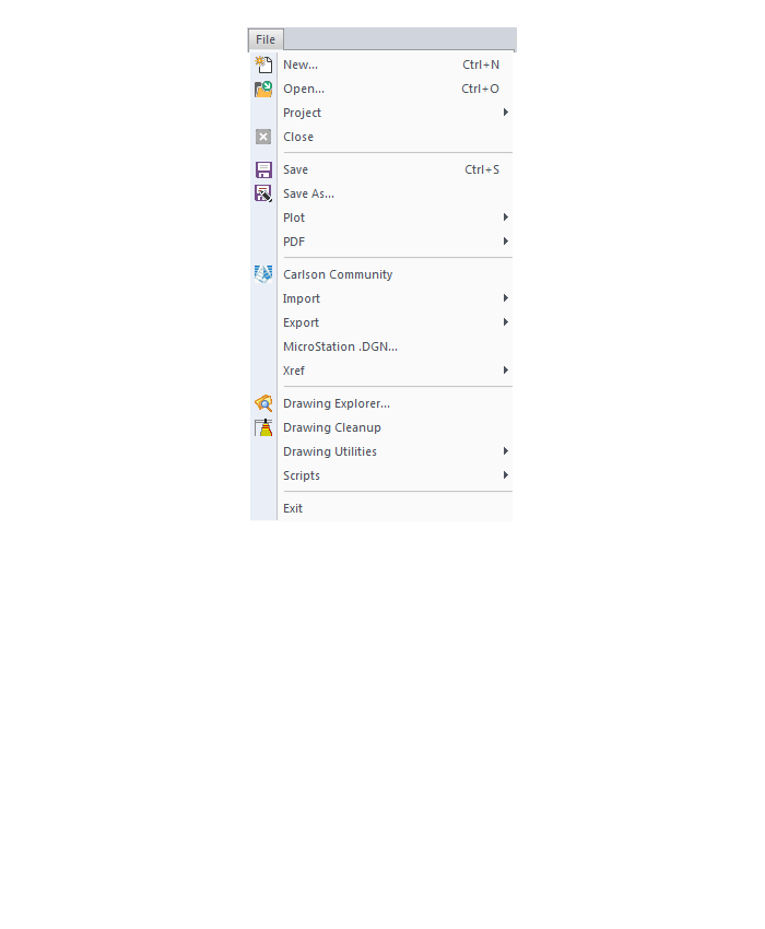
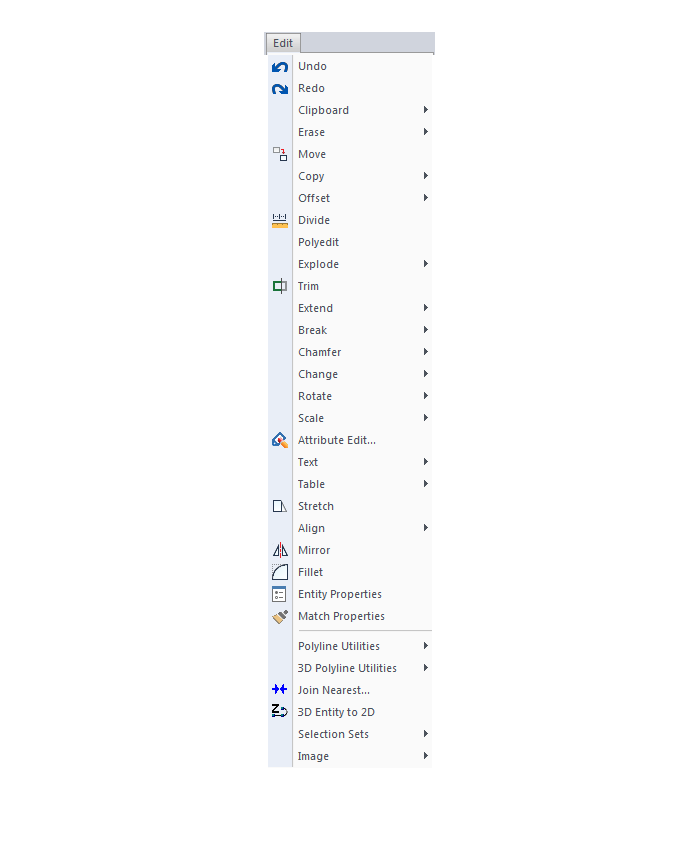
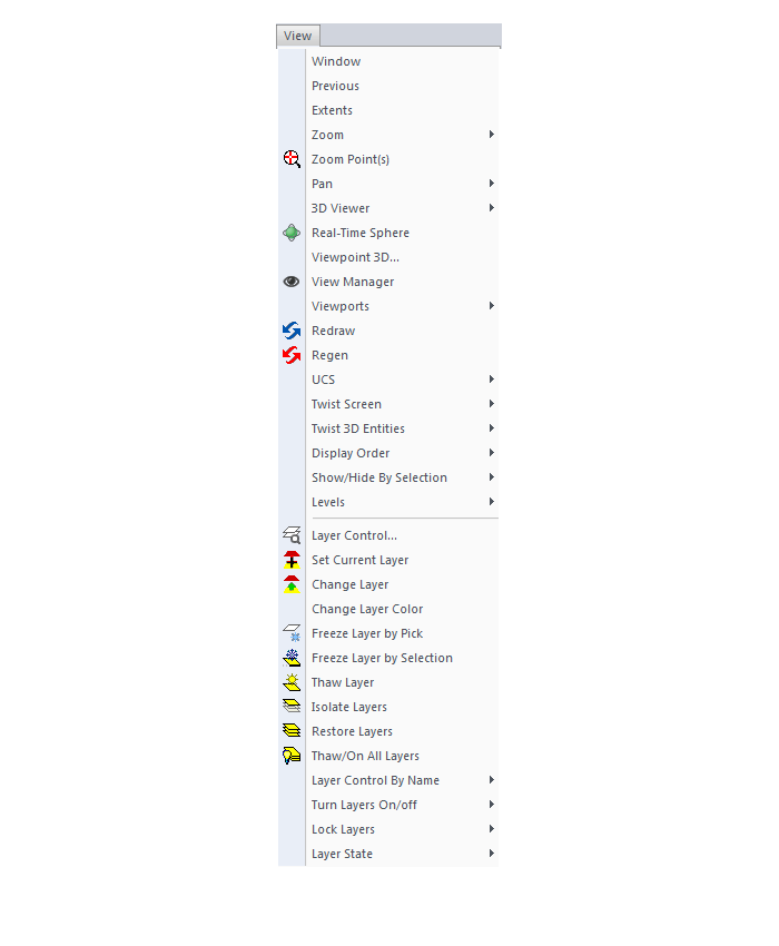
Menus in all non-OEM Carlson desktop programs
File Menu
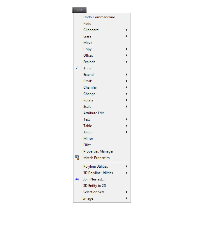
Edit Menu
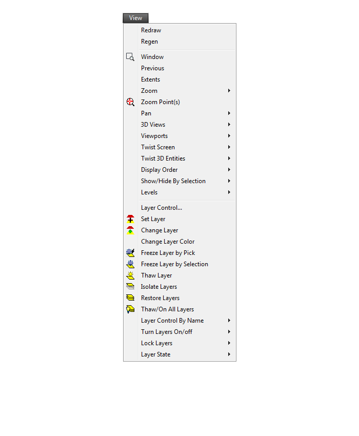
View Menu
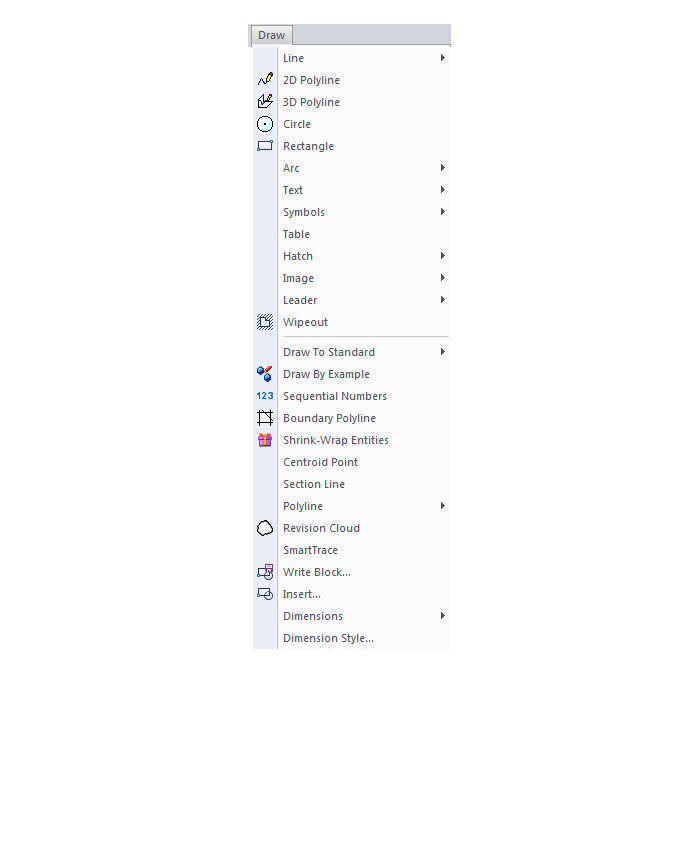
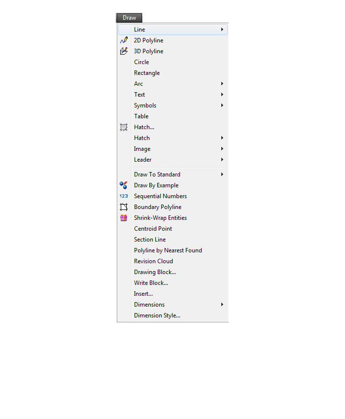
Draw Menu
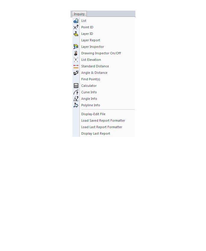
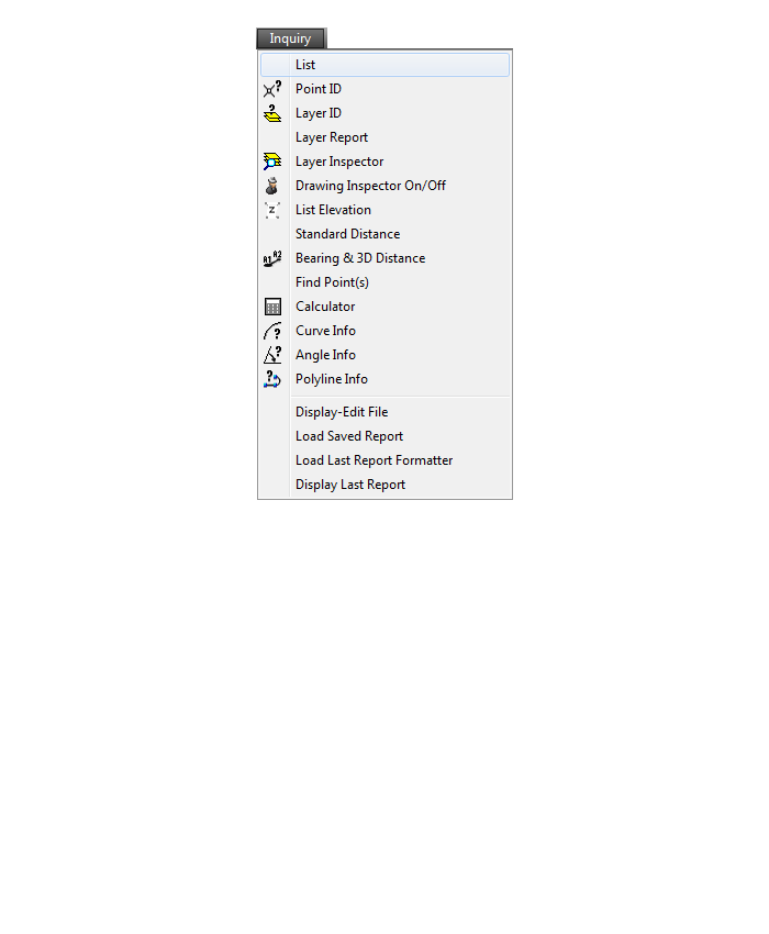
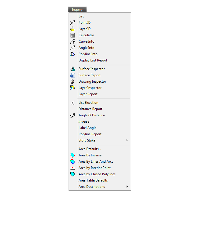
Inquiry Menu
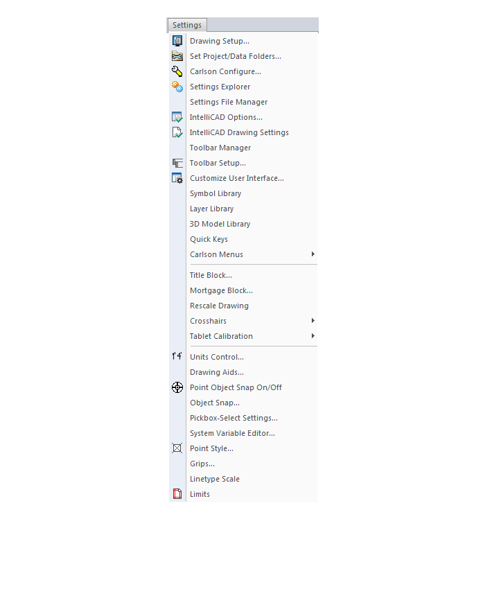
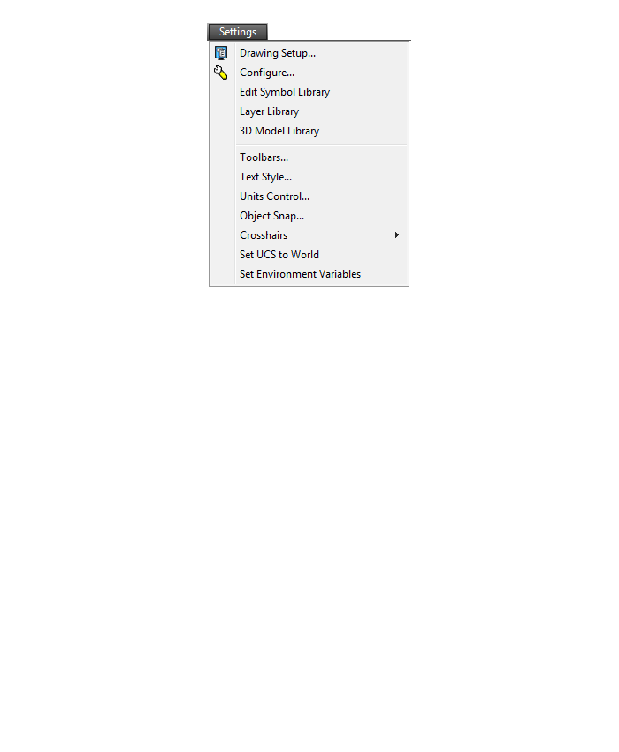
Settings Menu
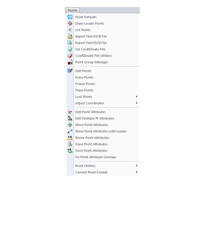
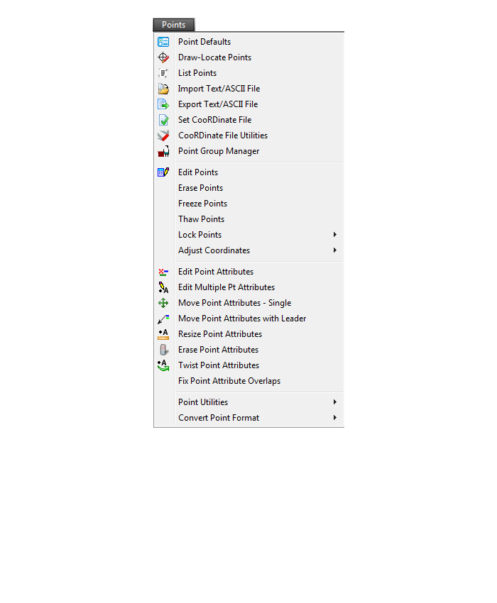
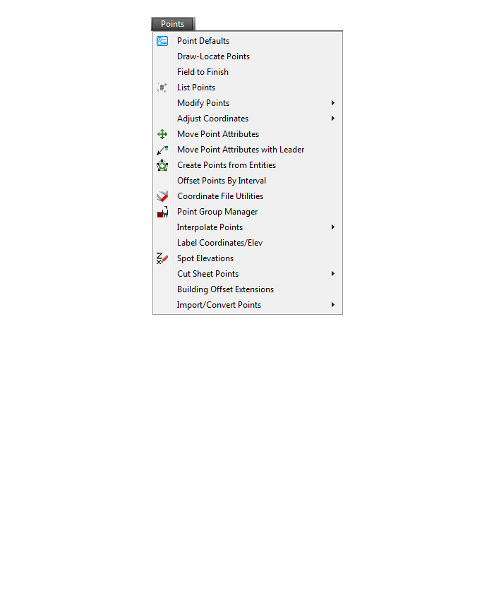
Points Menu
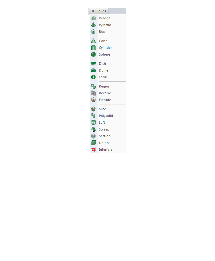
3D Solids Menu
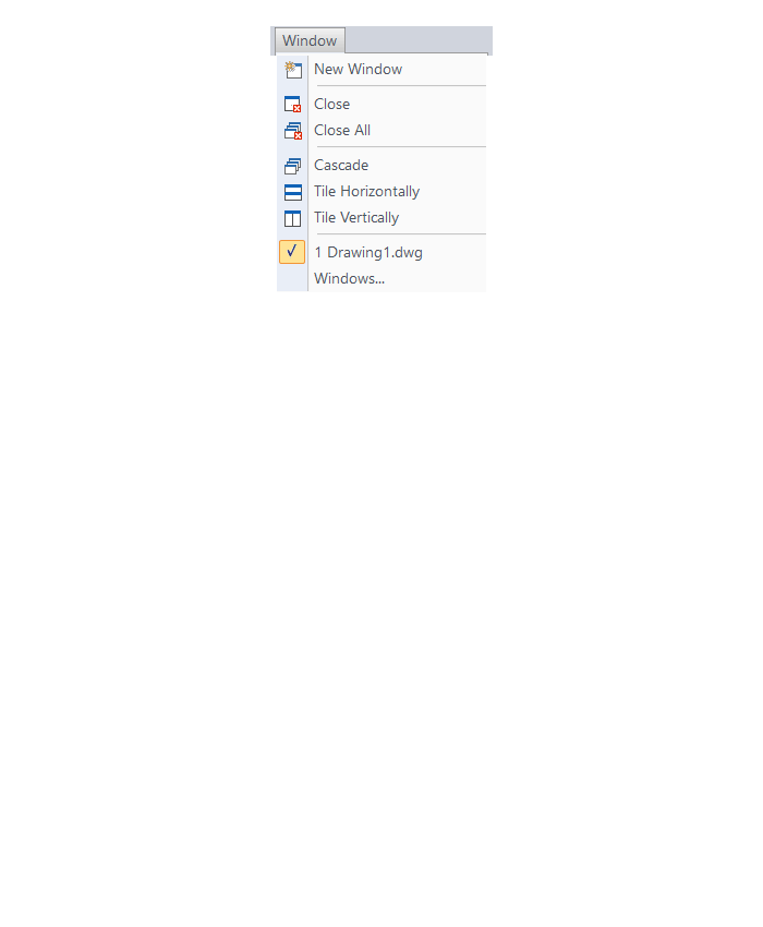
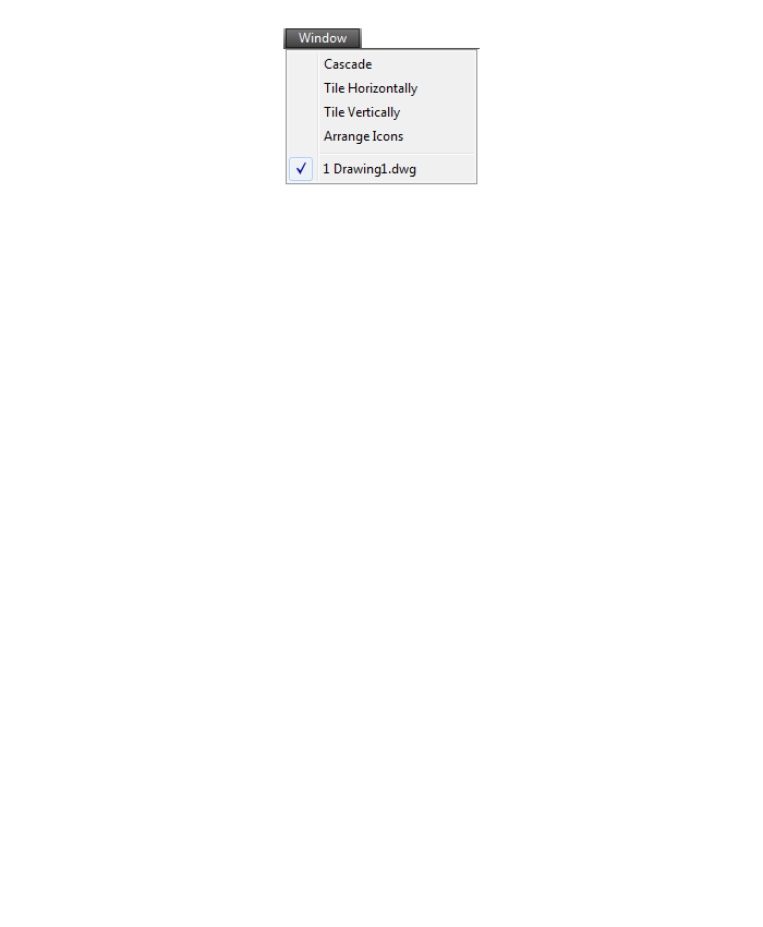
Window Menu
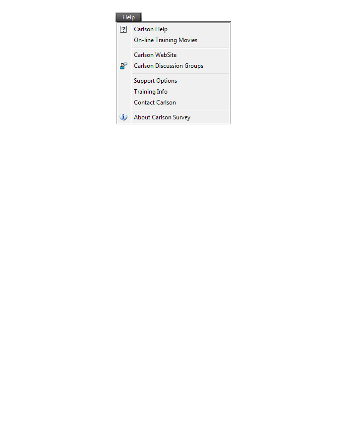
Help Menu

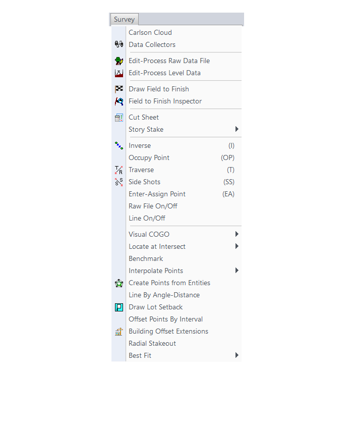
What features & menus are in the non-OEM Carlson Survey program? (a running thread)
+Survey 2017 with IntelliCAD or for your AutoCAD

Features and Benefits of Survey 2017
Carlson Survey is a comprehensive, CAD software program containing all of the tools that a surveyor needs. Here are some of the things you can do with Carlson Survey:
- Access both the Carlson Survey and the full C & G menus,
- Utilize the very best software tools for all your site design & subdivision design needs,
- Enter deed descriptions and generate a variety of lot reports including fully customizable legal descriptions,
- Enter deed descriptions and correlate field located property corners with deed property corners to find the best fit orientation & alignment,
- Use the Deed Reader command to extract deed line and curve data from a text file (the text file can sometimes be generated using the OCR feature of scanning software),
- Use the Lot Network feature to create a dynamic subdivision design that takes into account road centerline and right of way, building setbacks, wetland or poor soils areas and inserts one or more building footprints onto each lot,
- Have full point management capabilities including data collector download/upload, import/export points in text and most other formats including Civil 3d,
- Process raw data files using various methods via CAD software including SurvNet Least Squares,
- Perform dozens of COGO functions,
- Use Field to Finish (F2F) to process automatic linework and description key/description code definitions,
- Utilize dozens of time-saving point stake out commands,
- Import surfaces from Civil 3d and Google Earth®,
- Create surface model files for existing and proposed conditions,
- Edit the contours generated from a surface model and automatically update the underlying TIN file,
- Design and balance cut and fill for one or more building pads at a time,
- Calculate earthwork volumes between two surfaces including building pads, stockpiles and borrow pits,
- Create, define, edit and draw centerline alignments using a variety of methods including best fit,
- Create, define, edit and draw profiles using a variety of methods,
- Automatically update stationing when centerlines change, profiles when centerlines or surfaces change, etc,
- Automatically generate plan and profile sheets in model or paper space,
- Import, edit and export GIS shape files,
- Import a variety of image files including MrSid and geo-referenced TIF and JPG files.
Menus in Survey 2017
Menu bar in Survey 2017 showing the compact version of the CG Survey menu

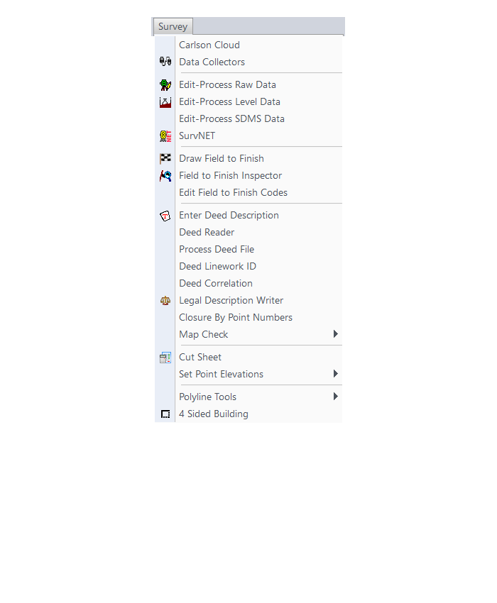
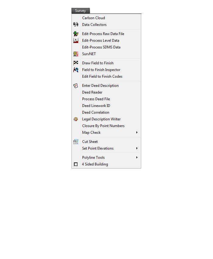
Survey Menu
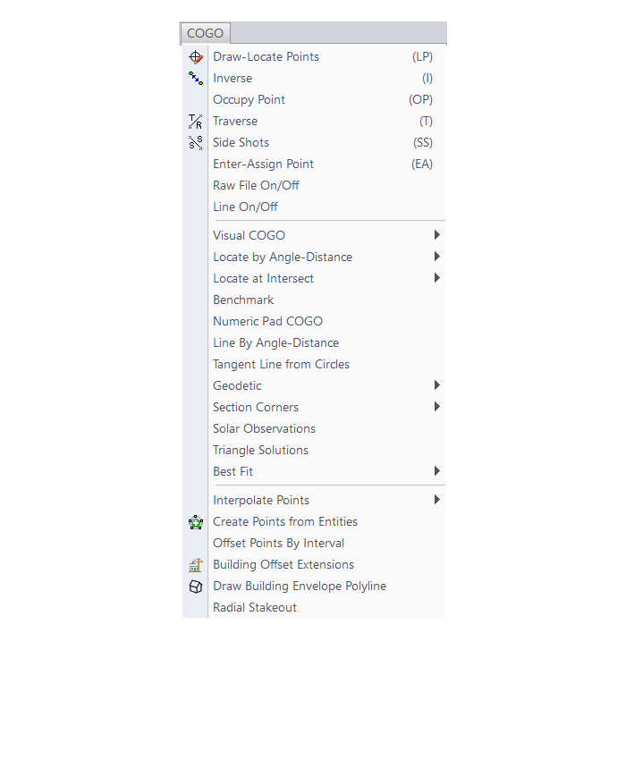
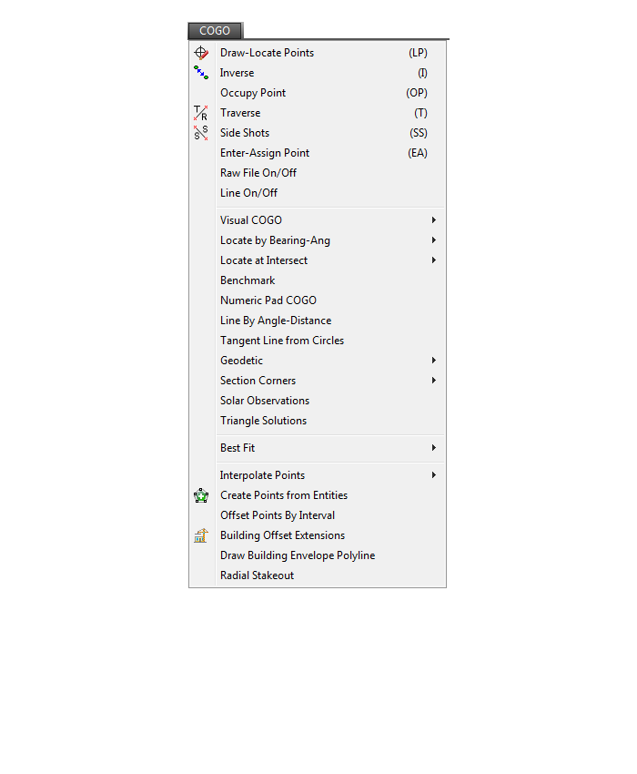
COGO Menu
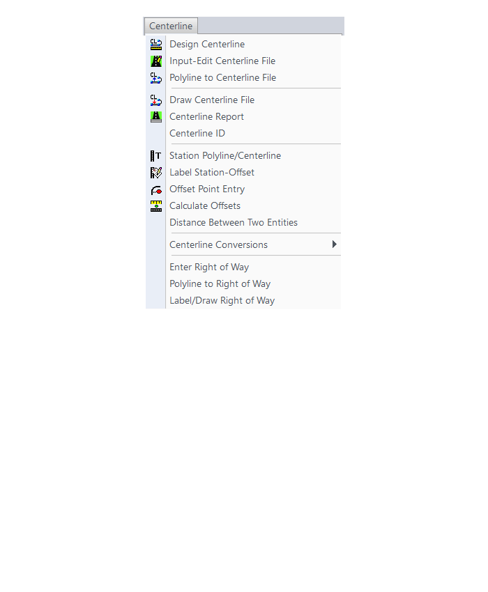
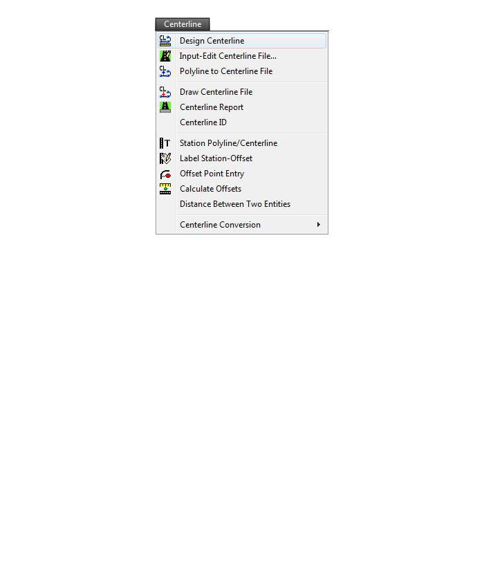
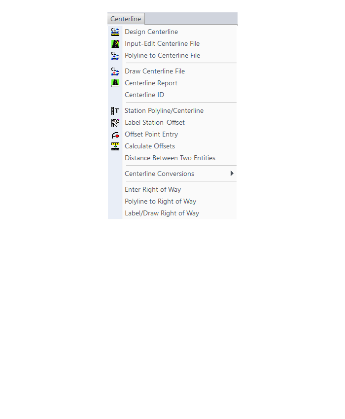
Centerline Menu
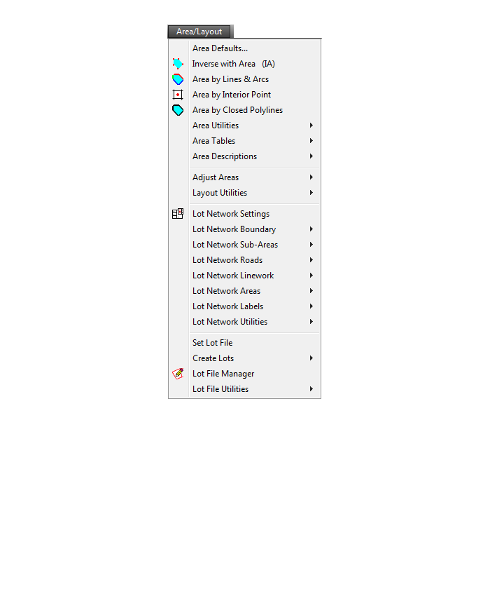
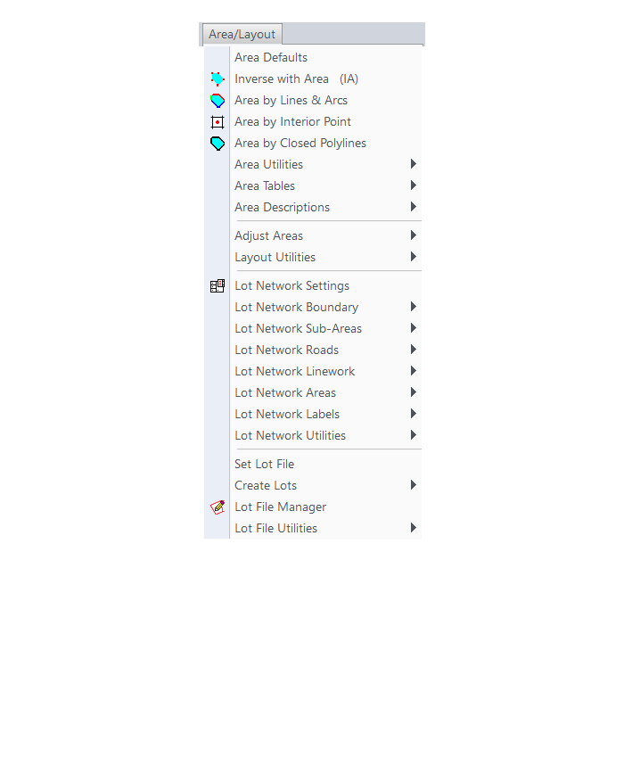
Area/Layout Menu

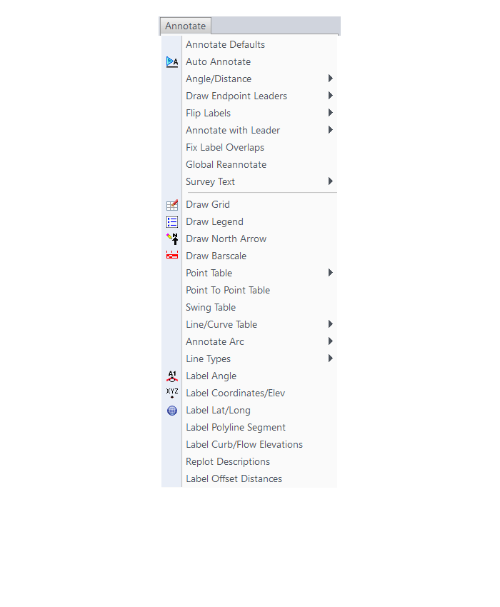
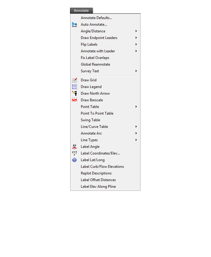
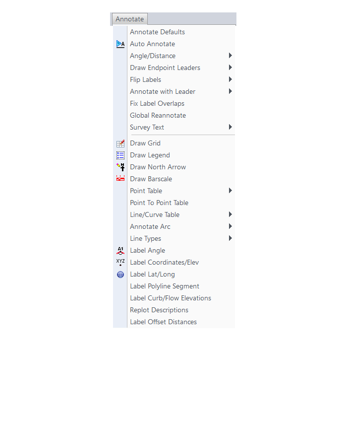
Annotate Menu
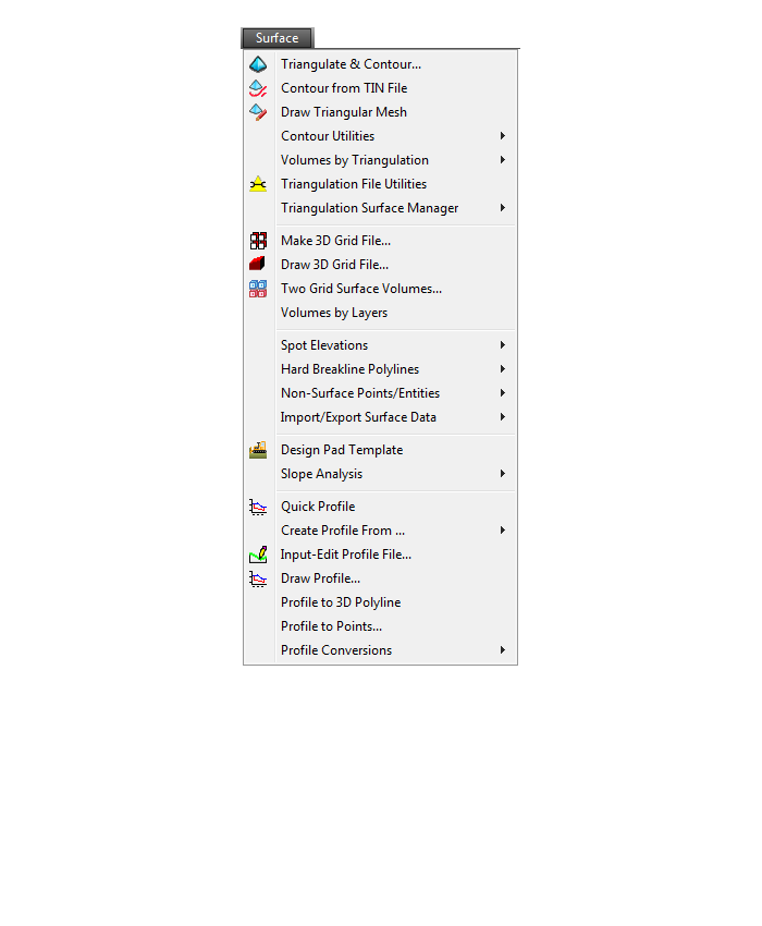
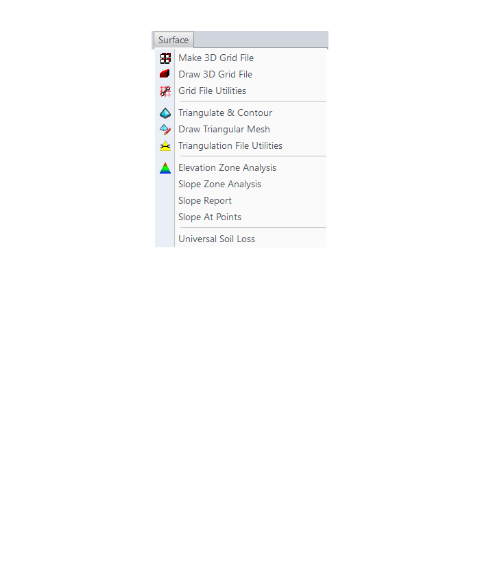
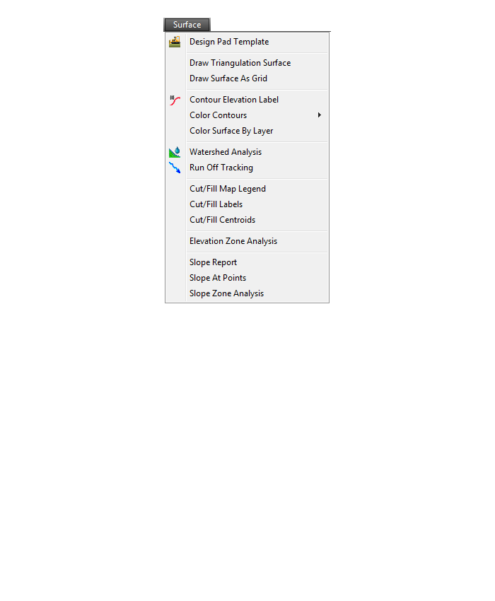
Surface Menu

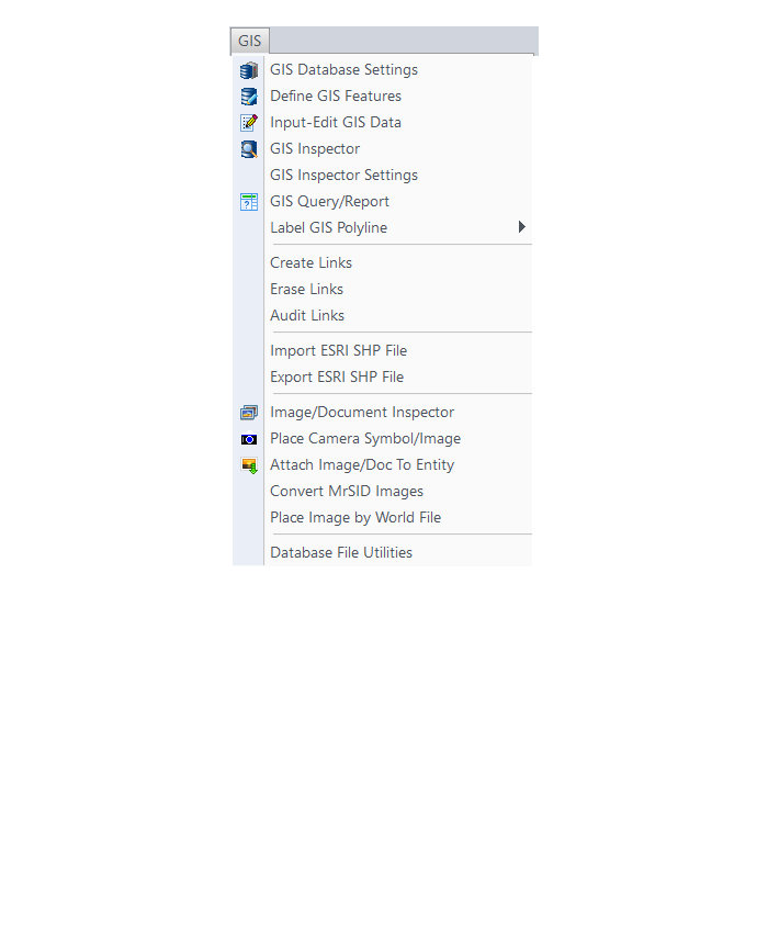
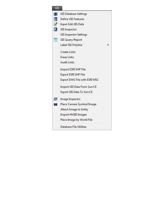
GIS Menu
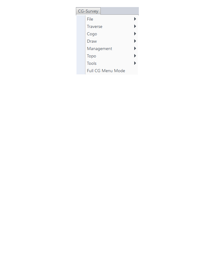
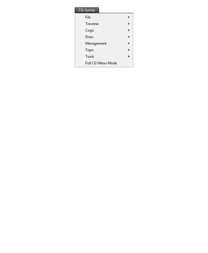
CG-Survey Menu
Menu bar in Survey 2017 showing the expanded version of the CG-Survey menu

The menus below are available when using the expanded version of the CG-Survey menu
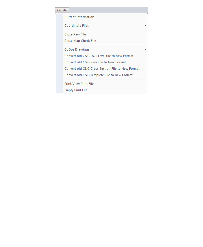
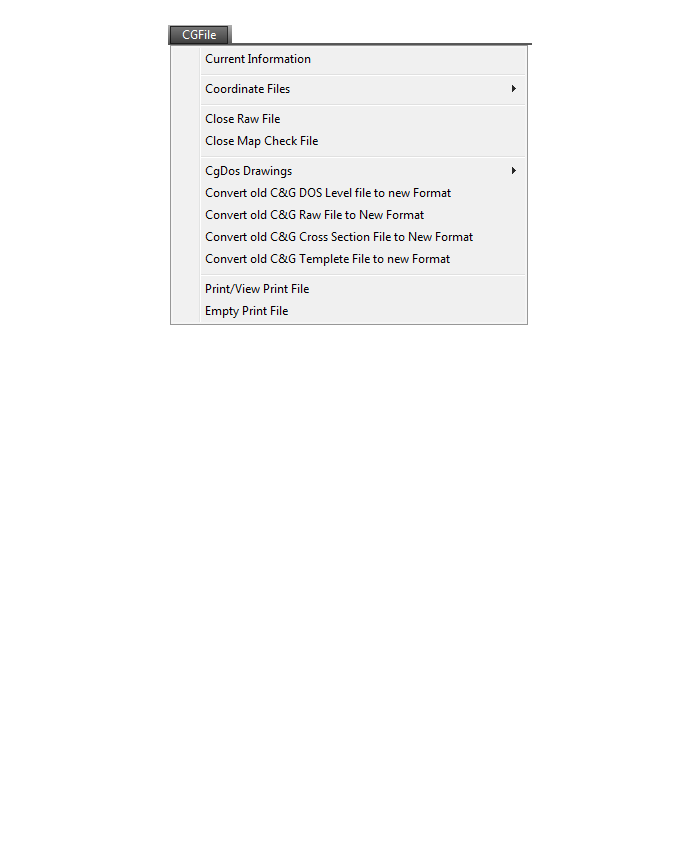
CG File Menu
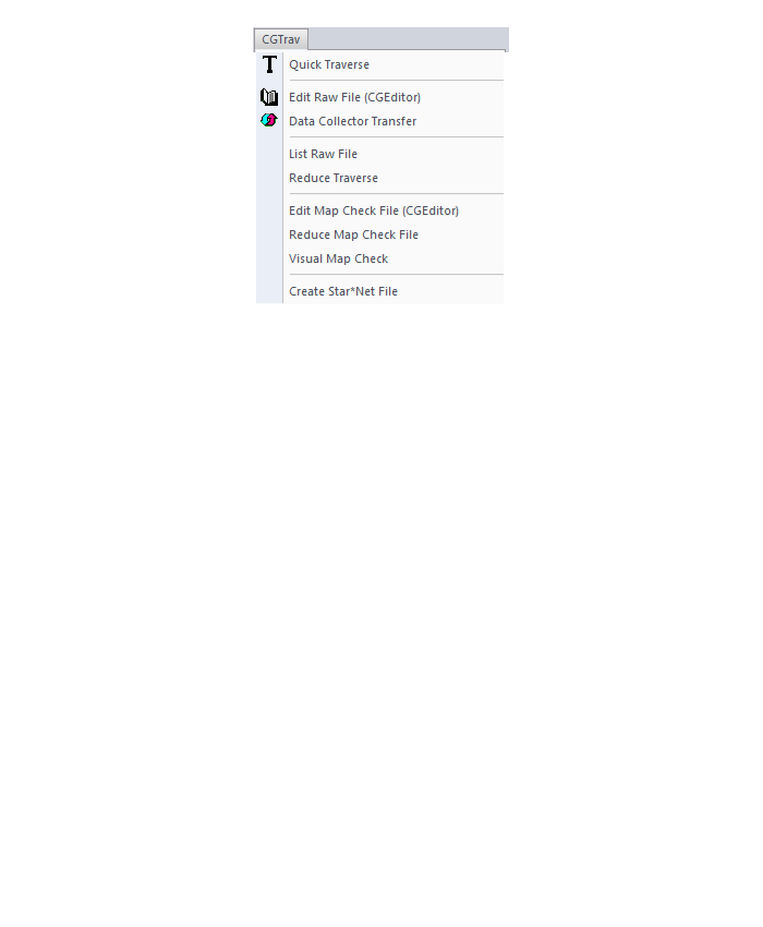
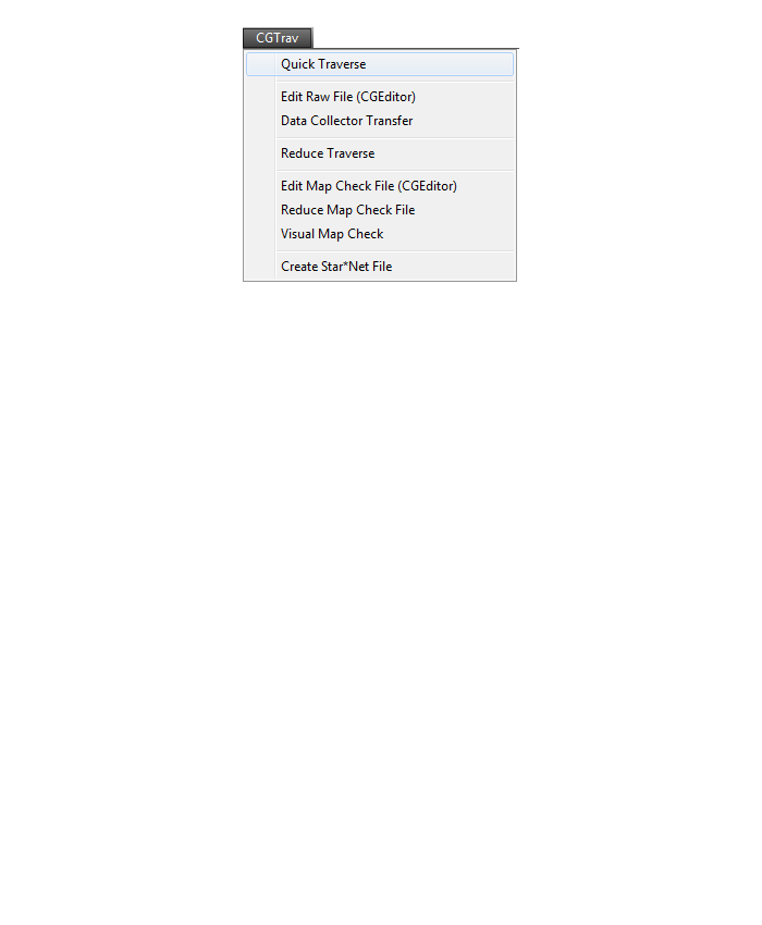
CG Trav Menu
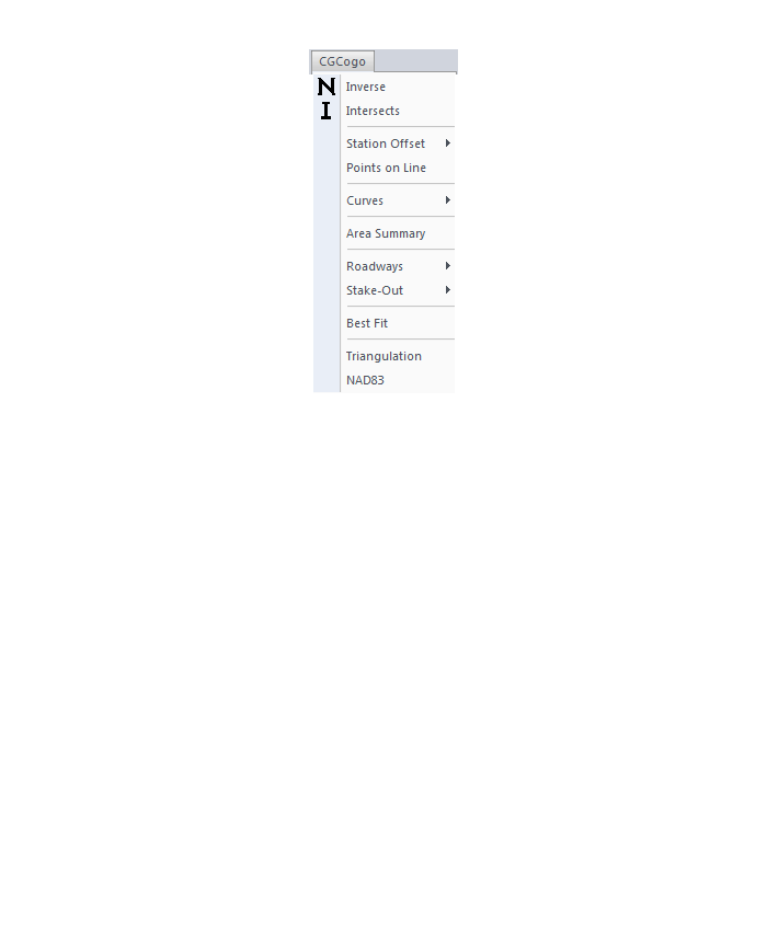
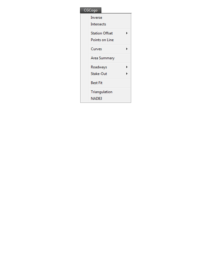
CG Cogo Menu
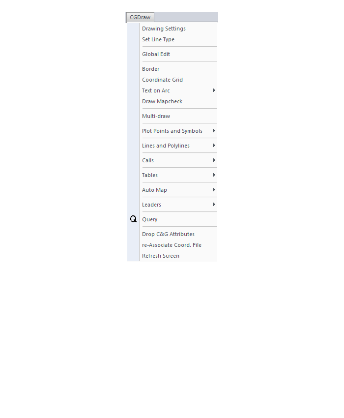
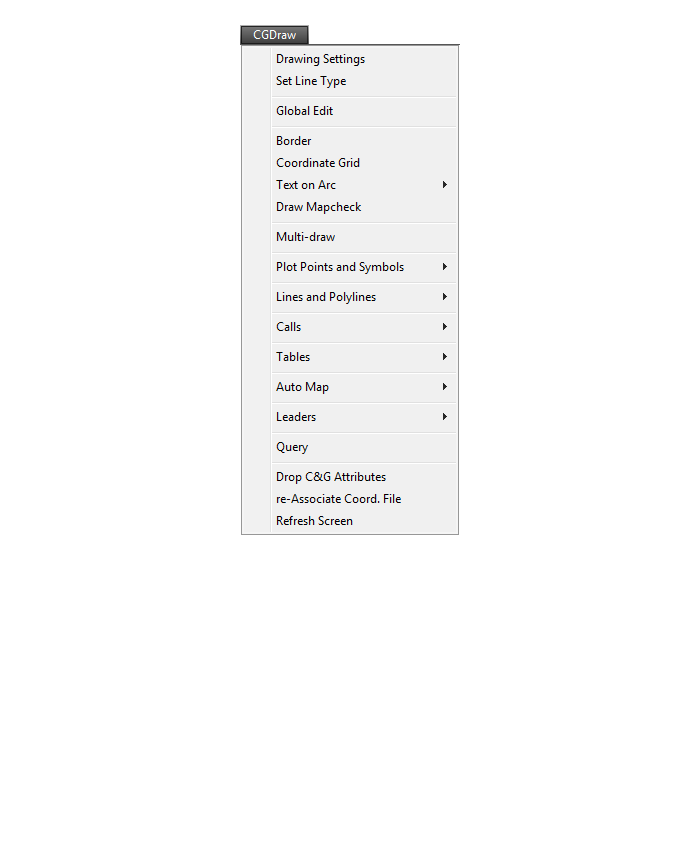
CG Draw Menu
CG Mngmt Menu

CG Topo Menu

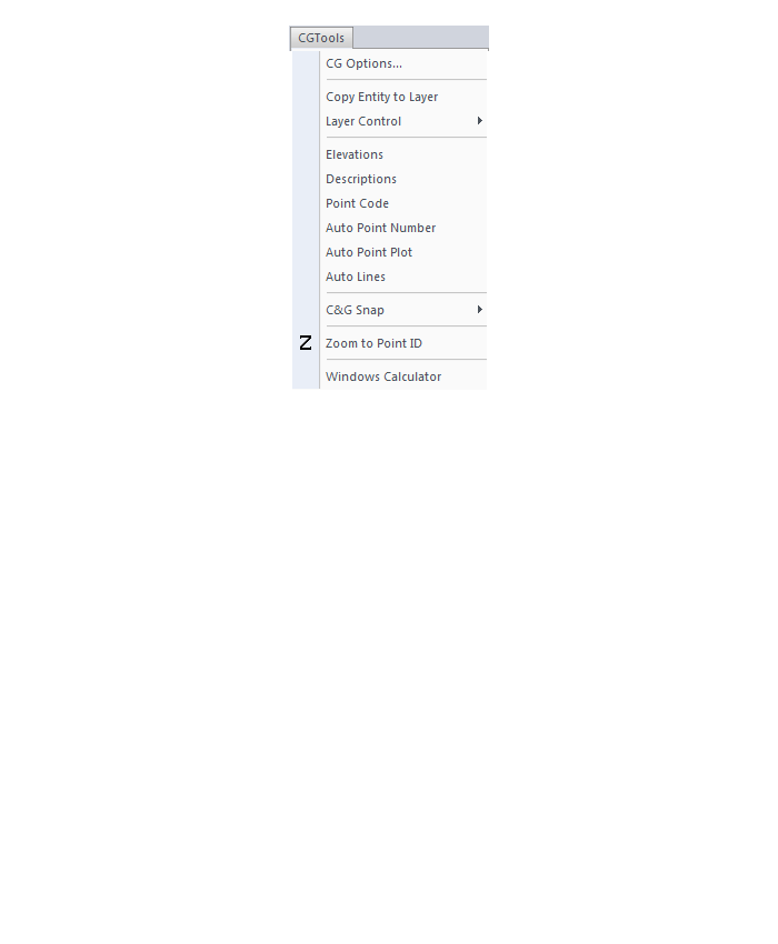
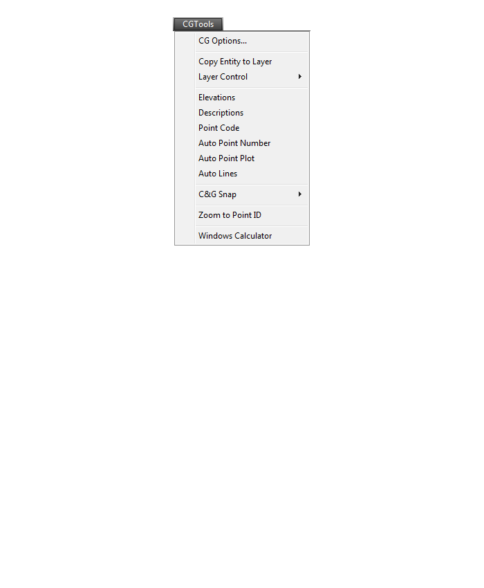
CG Tools Menu
The menus below are in all non-OEM programs of Carlson 2017 desktop software
(Click image to see more)
What features & menus are in Carlson Survey with embedded AutoCAD (OEM)? (a running thread)
+Survey 2017 with embedded AutoCAD (OEM)

Features and Benefits of Survey 2017 with embedded AutoCAD (OEM)
Carlson Survey is a comprehensive program containing all of the tools that a surveyor needs. Here are some of the things you can do with Carlson Survey:
- Access both the Carlson Survey and the full C & G menus,
- Utilize the very best software tools for all your site design & subdivision design needs,
- Enter deed descriptions and generate a variety of lot reports including fully customizable legal descriptions,
- Enter deed descriptions and correlate field located property corners with deed property corners to find the best fit orientation & alignment,
- Use the Deed Reader command to extract deed line and curve data from a text file (the text file can sometimes be generated using the OCR feature of scanning software),
- Use the Lot Network feature to create a dynamic subdivision design that takes into account road centerline and right of way, building setbacks, wetland or poor soils areas and inserts one or more building footprints onto each lot,
- Have full point CAD management capabilities including data collector download/upload, import/export points in text and most other formats including Civil 3d,
- Process raw data files using various methods including SurvNet Least Squares,
- Perform dozens of COGO functions,
- Use Field to Finish (F2F) to process automatic linework and description key/description code definitions,
- Utilize dozens of time-saving point stake out commands,
- Import surfaces from Civil 3d and Google Earth®,
- Create surface model files for existing and proposed conditions,
- Edit the contours generated from a surface model and automatically update the underlying TIN file,
- Design and balance cut and fill for one or more building pads at a time,
- Calculate earthwork volumes between two surfaces including building pads, stockpiles and borrow pits,
- Create, define, edit and draw centerline alignments using a variety of methods including best fit,
- Create, define, edit and draw profiles using a variety of methods,
- Automatically update stationing when centerlines change, profiles when centerlines or surfaces change, etc,
- Automatically generate plan and profile sheets in model or paper space,
- Import, edit and export GIS shape files,
- Import a variety of image files including MrSid and geo-referenced TIF and JPG files.
Menus in Survey 2017 with embedded AutoCAD (OEM)
Menu bar in Survey 2017 showing the compact version of the CG-Survey menu
The menus below are available in Carlson Survey 2017 with embedded AutoCAD (OEM)
File Menu

Edit Menu
View Menu
Draw Menu
Inquiry Menu
Settings Menu

Points Menu
Survey Menu
COGO Menu
Centerline Menu
Area/Layout Menu
Annotate Menu
Surface Menu
GIS Menu
CG-Survey Menu
Window Menu
Help Menu
Menu bar in Survey 2017 showing the expanded version of the CG-Survey menu

The menus below are available when using the expanded version of the CG-Survey menu
CG File Menu
CG Trav Menu
CG Cogo Menu
CG Draw Menu
CG Mngmt Menu

CG Topo Menu

CG Tools Menu
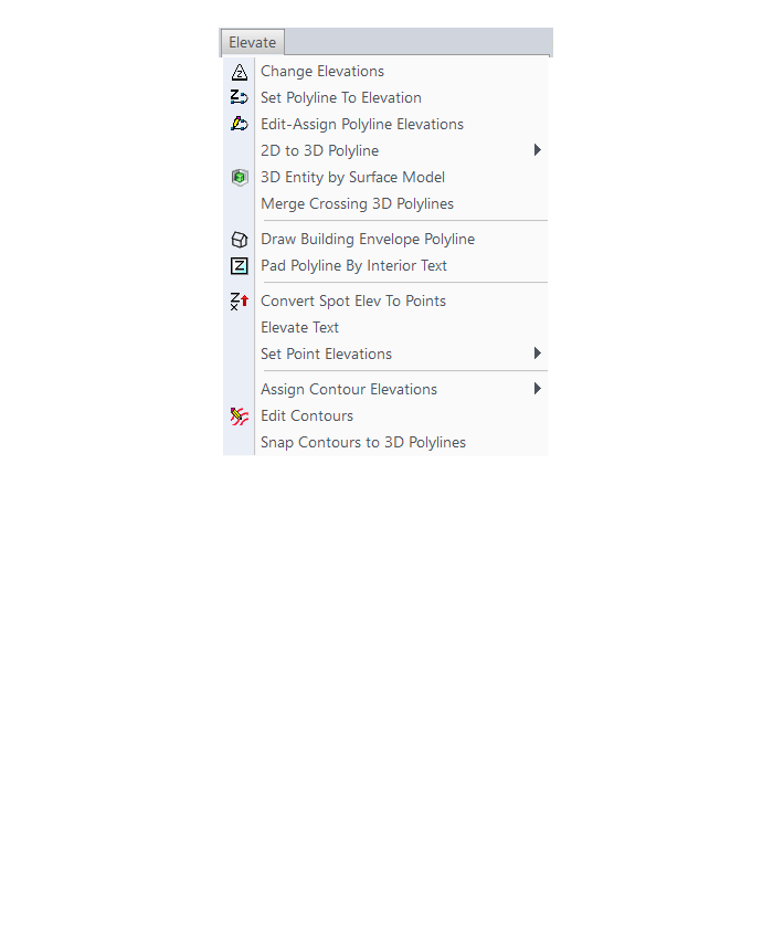
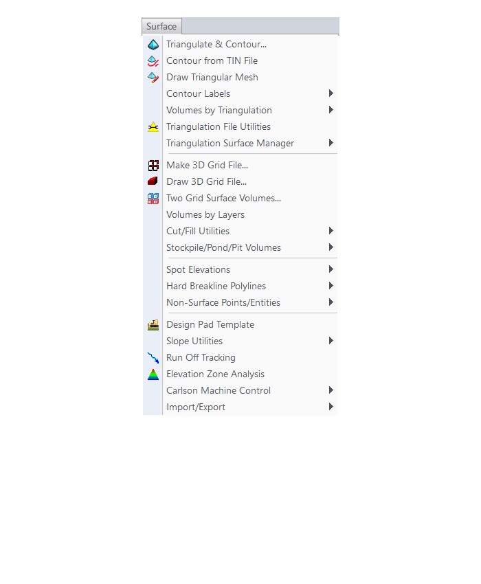
What features & menus are in Carlson Civil? (a running thread)
+Carlson Civil 2017

Features and Benefits of Civil 2017
- Utilize the very best Carlson software support tools for all your design build, site design & site grading, subdivision design & subdivision grading and road design & road grading needs,
- Perform tasks associated with civil BIM (Building Information Modeling),
- Use the Lot Network feature to create a dynamic subdivision design that takes into account road centerline and right of way, building setbacks, wetland or poor soils areas and inserts one or more building footprints onto each lot,
- Use vehicle path tracking to ensure adequate roadway clearance,
- Create, define, edit and draw centerline alignments using a variety of methods including best fit,
- Easily elevate 2d, zero-elevation polylines from points, text or text with a leader for detailed site grading,
- Label elevation, slope and other properties of polylines,
- Design a centerline and profile along a surface that maintains a maximum slope,
- Import surfaces from Civil 3d and Google Earth®,
- Create surface model files for existing and proposed conditions,
- Design and balance cut and fill for one or more building pads at a time,
- Edit the contours generated from a surface model and automatically update the underlying TIN file,
- Calculate earthwork volumes between two surfaces including building pads, stockpiles and borrow pits,
- Report storage volumes for bench and valley ponds that can be designed using various design criteria such as adding multiple interior benches and automatically removing the berm in cut conditions,
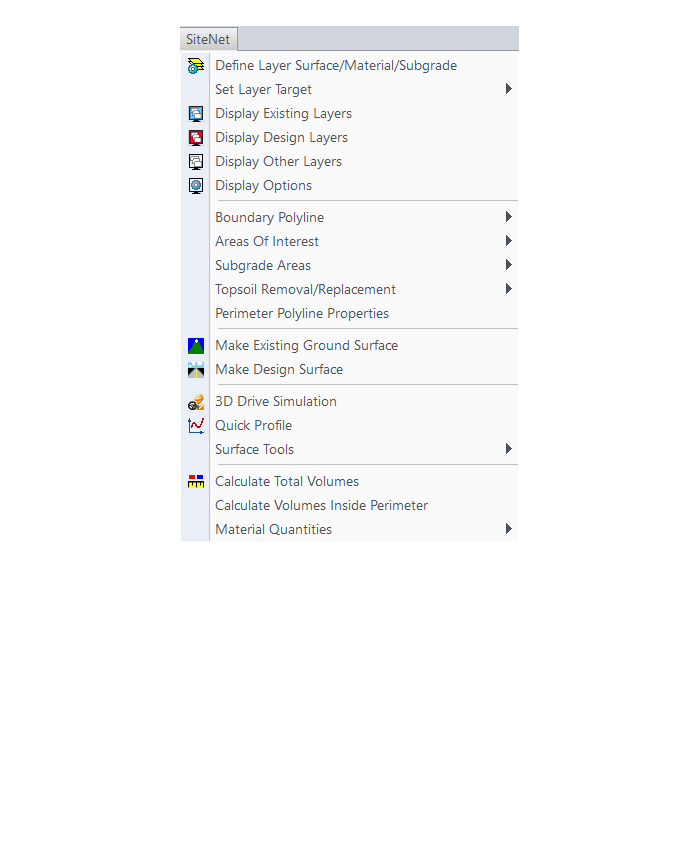
- Use the layer-based SiteNet commands to calculate and report volumes and/or quantities:
- Of an entire site or within a perimeter Polyline,
- Of cut & fill dirt; of topsoil removal & replacement; of materials such as asphalt, stone, concrete and curb; and of pipe and structure depth,
- That can be exported directly to Microsoft Excel®,
- Create cut & fill color maps or a grid of cut and fill labels,
- Create, define, edit and draw profiles using a variety of methods including best fit,
- Create, define, edit and draw cross sections using a variety of methods,
- Define, edit and draw typical cross sections to create a library of roadway templates that meet detailed design standards,
- Use the Road Network feature to dynamically design a network of highways or roads that automatically tie intersections together, allow detailed grading at each intersection and cul-de-sac and allow real-time volume determination as the road profile is adjusted,
- Design roads that that incorporate varying roadway widths, multiple templates, super elevation, topsoil removal & replacement, road rehabilitation including overlays after leveling or milling operations and more,
- Automatically elevate building pads and property lot lines using grading rules applied to a road design,
- Process Road Design for final sections, final contours and volumes,
- Pick a button to “Process” or have updates automatically occur when changes to centerlines or surfaces affect profiles, changes to profiles affect cross sections or changes to surfaces affect storm or sewer structures,
- Automatically generate a Carson software support plan and profile sheets in model or paper space where the plan and profile views can be shifted or rotated incrementally with the pick of a button,
- View your entities or surfaces in 3d or drive through them in a humvee, police car or school bus.
Menus in Civil 2017
Menu Bar in Civil 2017

The menus below are available in Carlson Civil 2017
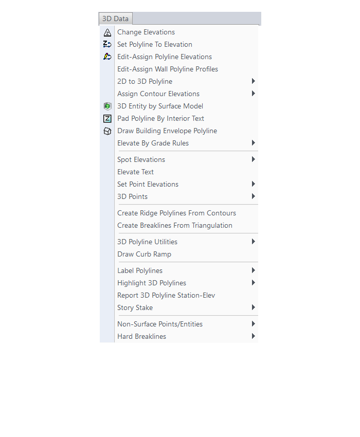
3D Data Menu
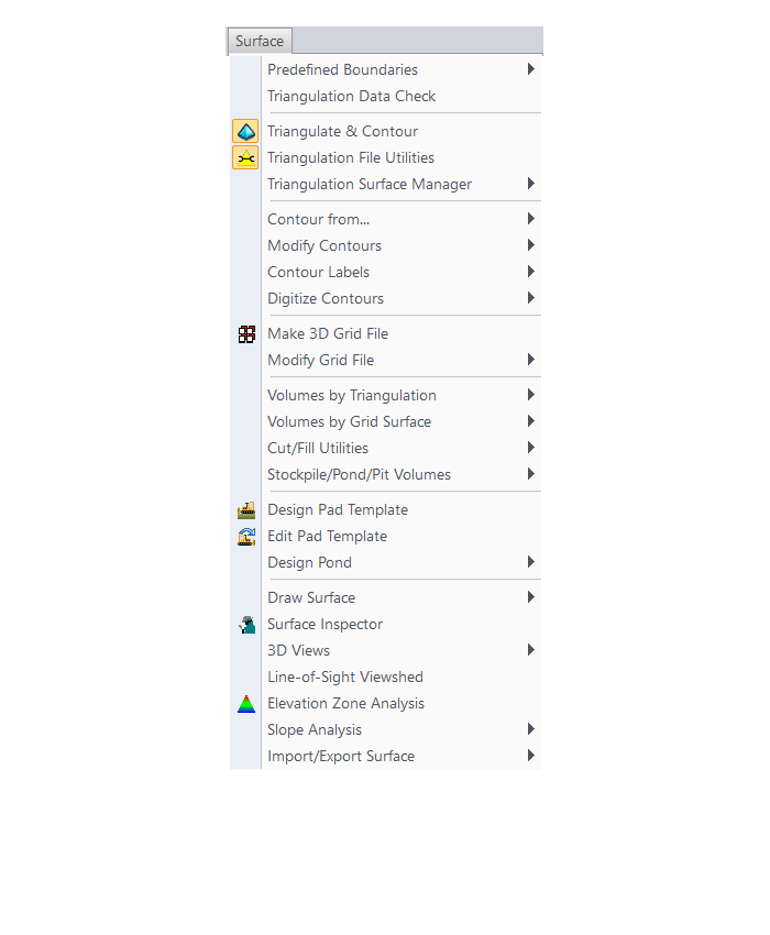
Surface Menu
SiteNet Menu
Centerline Menu
Profiles Menu

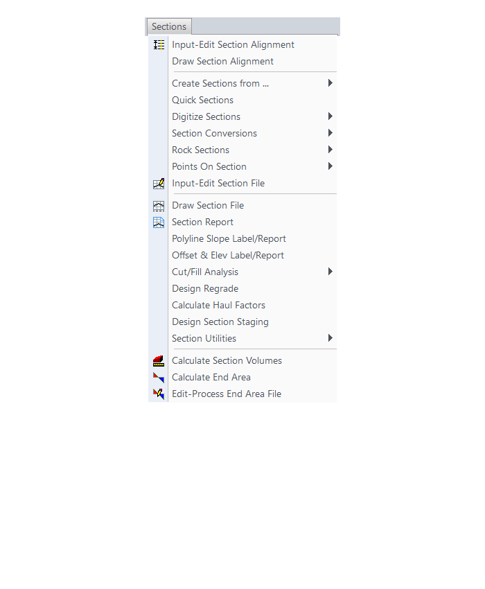
Sections Menu
Roads Menu

Area Layout Menu
Annotate Menu
The menus below are in all non-OEM programs of Carlson 2017 desktop software
(Click image to see more)
What features & menus are in Carlson Hydrology? (a running thread)
+Carlson Hydrology 2017

Features and Benefits of Hydrology 2017
Here are some of the things you can do with Carlson Hydrology:
- Use it to perform all of your stormwater modeling and design or use it to compile data that can then be used in other hydrology programs,
- Link directly to other hydrology programs including HydroCAD®, Pizer HYDRA®, TR-20, SEDCAD, HEC-RAS and HEC-2,
- Analyze and design using either SCS or Rational method,
- Determine runoff volumes with easy-to-use, layer-based tools
- Track runoff and analyze watershed data within the entire watershed or just above a selected point – such as a catch basin,
- Create surface model files with CAD support for existing and proposed conditions
- Design and then report storage volumes for bench and valley ponds that can be designed using various design criteria such as adding multiple interior benches and automatically removing the berm in cut conditions,
- Create custom fields for pipe structures and inlet libraries,
- Tap extensive libraries for rainfall data, inlets, manholes and outlet structures,
- Pick a button to “Process” or have updates automatically occur when changes to road designs surfaces affect storm or sewer structures,
- Design sanitary sewer or storm pipe runs in a dockable palette or in a spreadsheet editor,
- Tie pipe design criteria to surfaces, centerlines and profiles
- Calculate inlet intercepted and bypass flows, gutter spread and depth, pipe flow depth and velocity, and hydraulic and energy grade lines
- Choose to match stormwater pipes at the crown or at the flowline
- Receive warnings for collisions and when pipe length, cover, slope, flow rates or other design criteria do not fall within an acceptable, customizable range
- Design ponds, spillways, orifices, weirs, multiple outlets, channels, culverts, pipes and lift stations
- Draft sewer pipe dynamically in plans, profiles and 3D
Menus in Hydrology 2017
Menu Bar in Hydrology 2017

The menus below are available in Carlson Hydrology 2017
Surface Menu
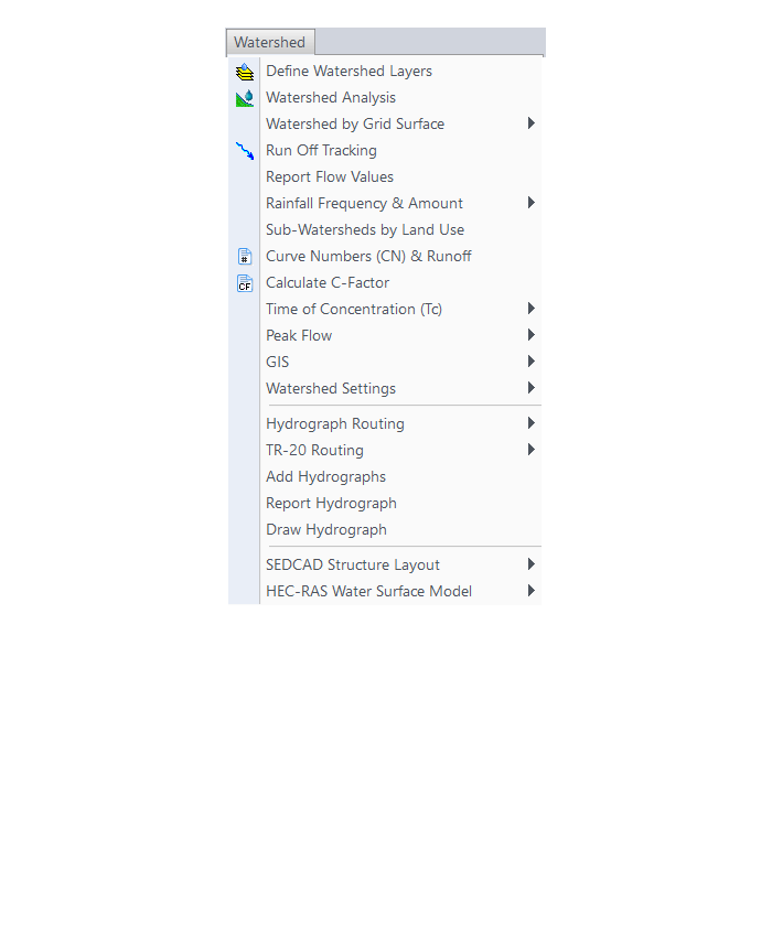
Watershed Menu
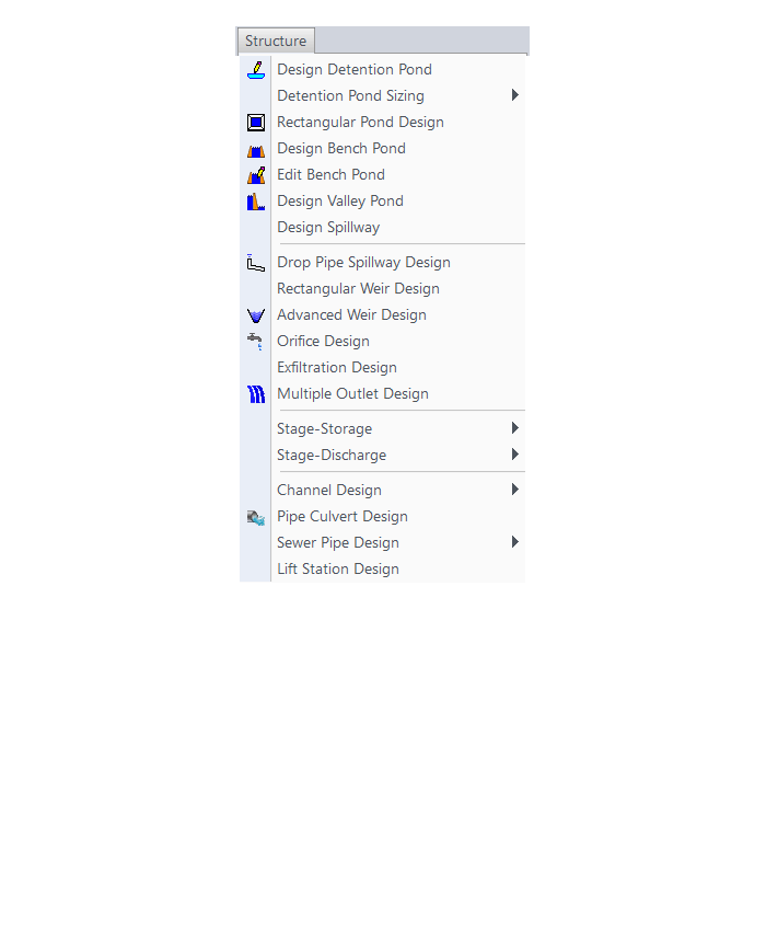
Structure Menu
Network Menu
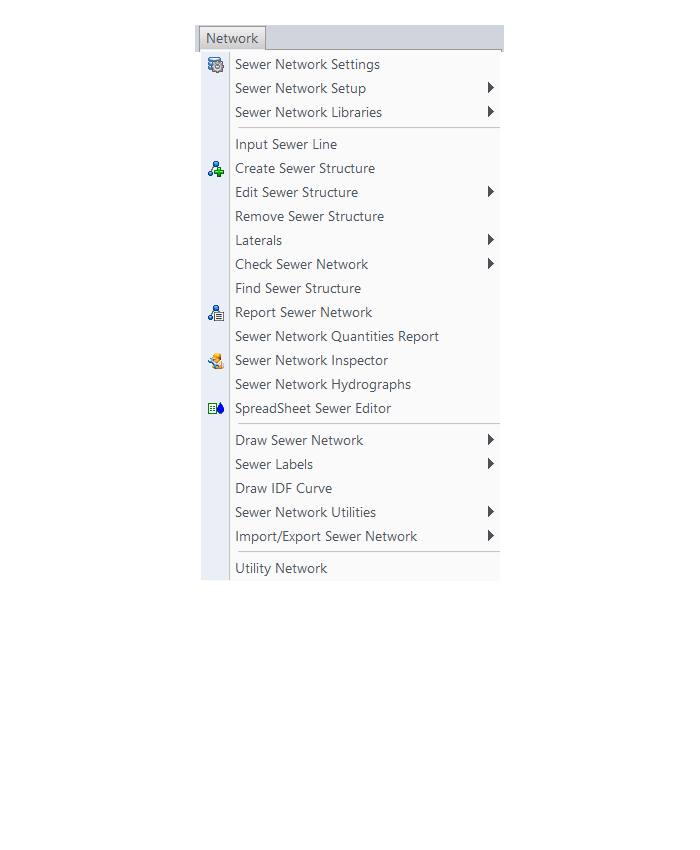
HydroCAD Menu
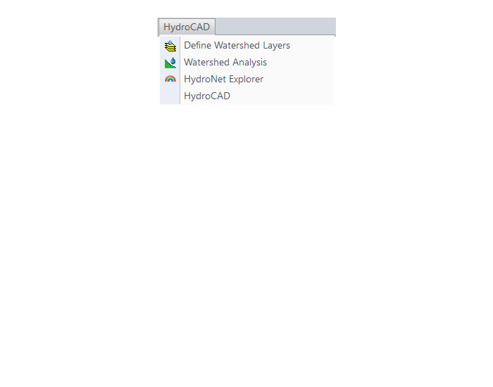
The menus below are in all non-OEM programs of Carlson 2017 desktop software
(Click image to see more)
What features & menus are in Carlson GIS? (a running thread)
+Carlson GIS 2017
Features and Benefits of GIS 2017
- Take advantage of the Carlson/Esri® partnership with these and other CAD software commands:
- Import/Export Esri SHP files
- Export DWG file with Esri MSC data
- Export Esri Projection file
- Import and Export GIS Data between Carlson GIS and Carlson SurvCE
- Work with many image formats including:
- Geo-referenced images
- Google Earth images
- CAD software images
- MrSID images
- Convert GIS data to and from AutoCAD Map
- Query and Report GIS generated entities
- Hatch & Label GIS generated polylines
- Create, Audit and Erase links to GIS database
- Define Note file prompts for data collection
Menus in GIS 2017
Menu Bar in GIS 2017
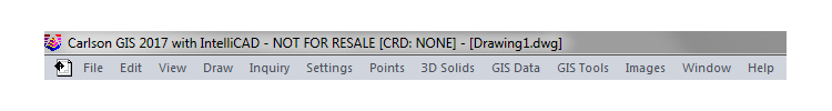
The menus below are available in Carlson GIS 2017
GIS Data Menu
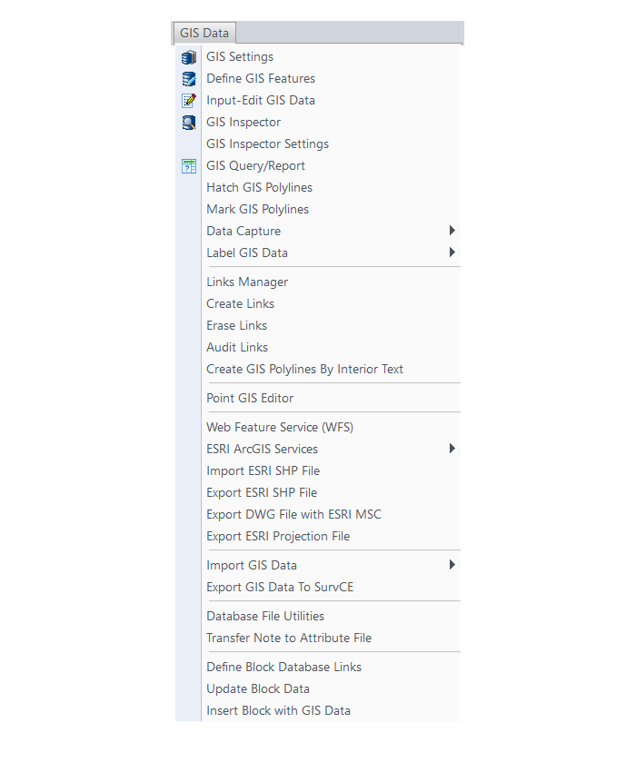
GIS Tools Menu
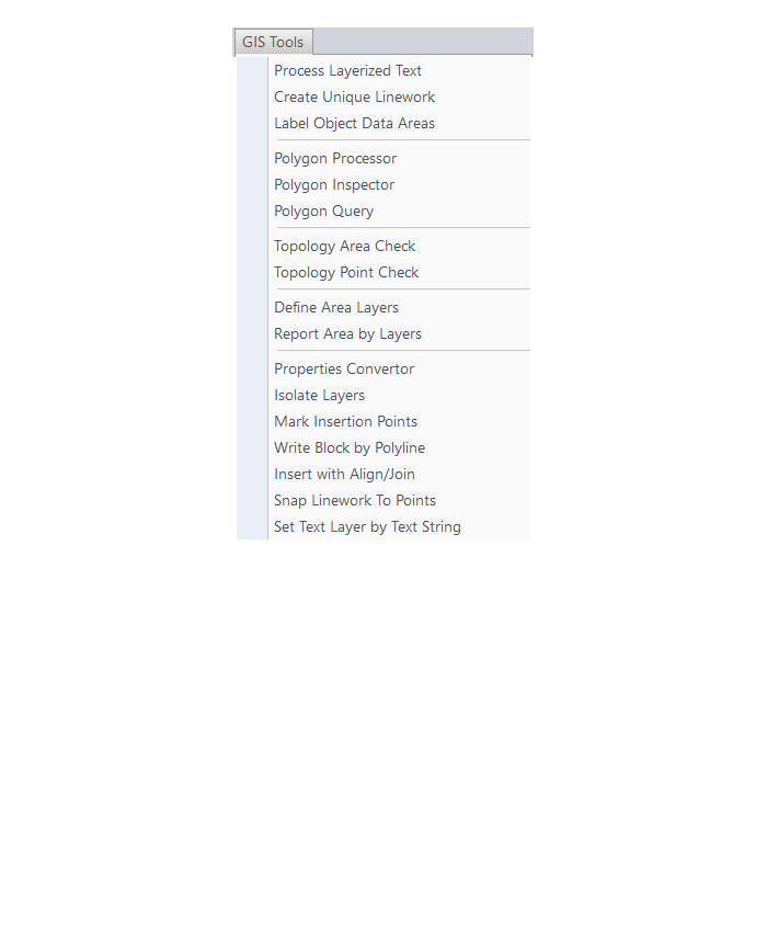
Images Menu
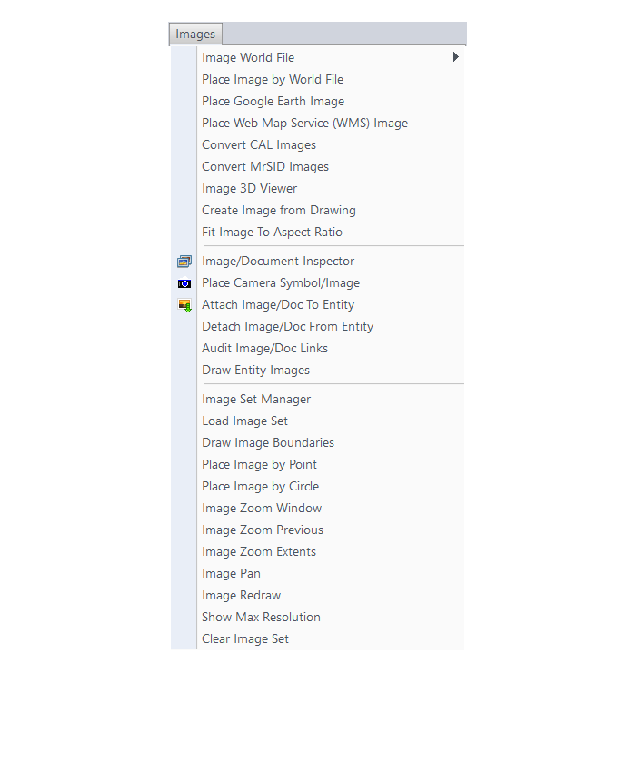
The menus below are in all non-OEM programs of Carlson 2017 desktop software
(Click image to see more)
What features & menus are in Carlson Construction? (a running thread)
+Carlson Construction 2017

Features and Benefits of Construction 2017
Fully supporting all of the major 3D Machine Control formats for today’s heavy equipment with 3D Machine Control Systems, Carlson Construction gives you the tools you need for taking your data into the 3D environment. Whether your Carlson software need is “Data Preparation,” “Site Preparation,” or specifically creating Machine Control Guidance Models, Carlson Construction will get the job done for you.
Menus in Construction 2017
Menu Bar in Construction 2017

The menus below are available in Carlson Construction 2017
Elevate Menu
Surface Menu
Takeoff Menu
Roads Menu

Survey Menu
Annotate Menu
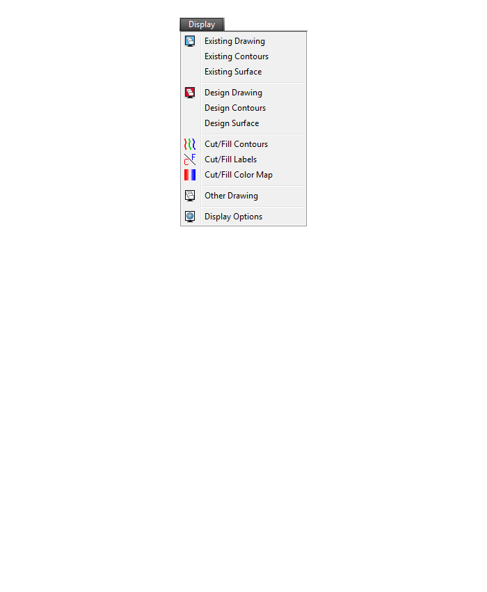
Display Menu

The menus below are in all non-OEM programs of Carlson 2017 desktop software
(Click image to see more)
What features & menus are in Carlson CADNet? (a running thread)
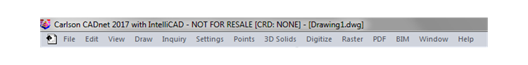
+Carlson CADNet 2017
Features and Benefits of CADNet 2017
Carlson CADnet, introduced in 2014, allows users to import faster images and PDF files and, if needed, even to merge multiple images into one file that can be digitized or otherwise converted by CAD software using a variety of raster-to-vector routines. CADNet also gives you many tools to help clean up text and linework generated from raster images.
Recent updates to CADNet gives you the ability to export drawing entities to 3D PDF files, import Sketchup files and import and export BIM models (doors, windows, walls, roofs, etc.) and bring them into CAD as CAD software entities; plus, CADnet includes a routine to export surfaces into BIM.
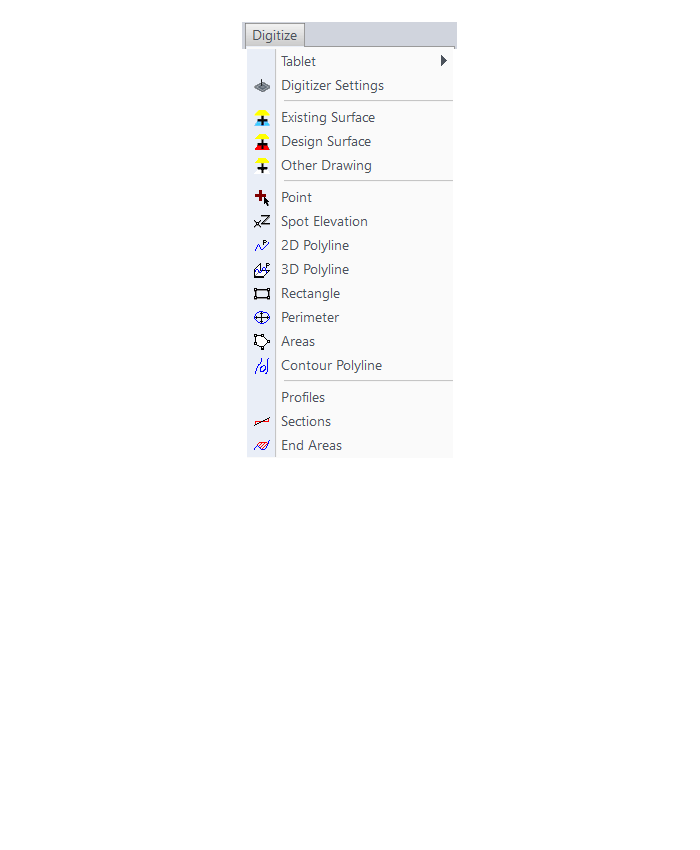
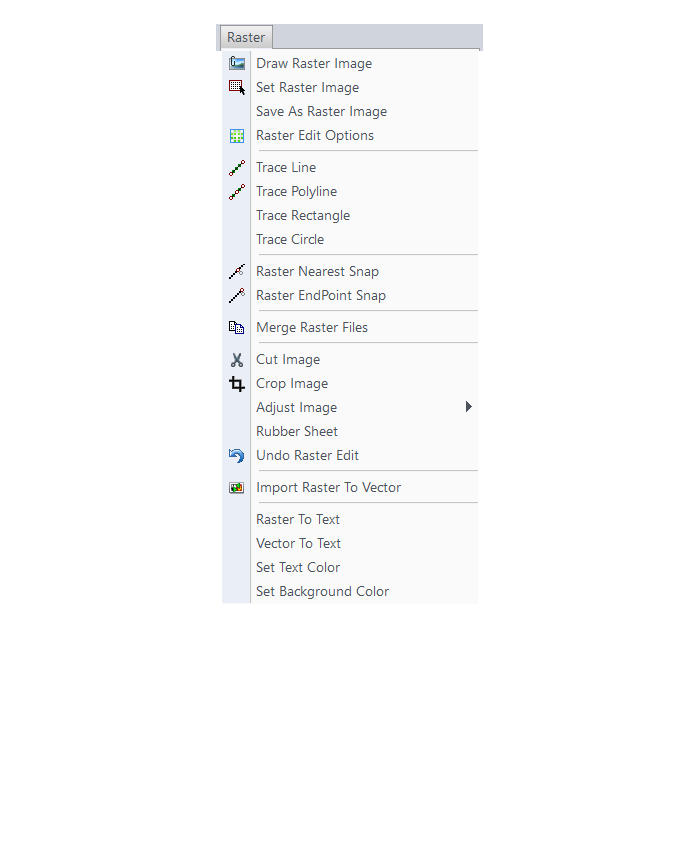
Menus in CADNet 2017
Menu Bar in CADNet 2017
The menus below are available in Carlson CADNet 2017
Digitize Menu
Raster Menu
PDF Menu

BIM Menu
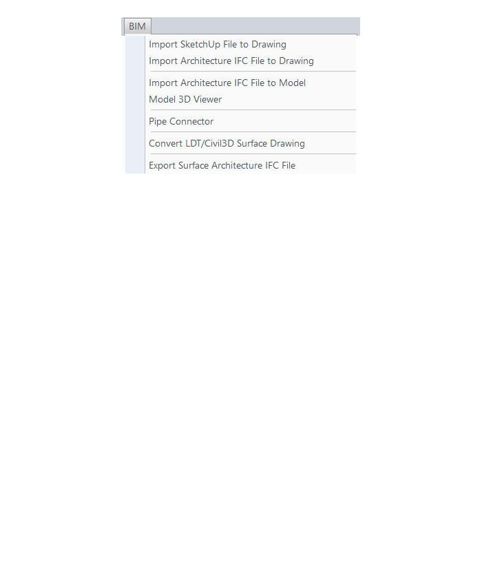
The menus below are in all non-OEM programs of Carlson 2017 desktop software
(Click image to see more)
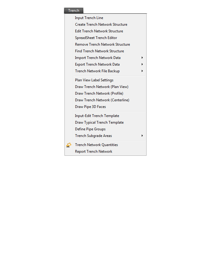
What features & menus are in Carlson Trench? (a running thread)
+Carlson Trench 2017
Features and Benefits of Trench 2017
Carlson Trench is for calculations related to installing pipes, sewers, or utility lines. The CAD software calculates the volume of the trench cut, the volume of backfill (excluding the pipe size), and the linear footage of pipe broken down by the pipe material, size, and/or depth.
Carlson Trench is fully integrated with Carlson Civil and Carlson Construction, and also Carlson Hydrology to meet the variety of customers’ needs.
Menus in Trench 2017
Menu Bar in Trench 2017
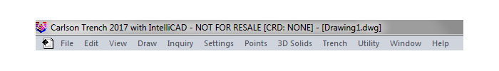
The menus below are available in Carlson Trench 2017
Trench Menu

Utility Menu

The menus below are in all non-OEM programs of Carlson 2017 desktop software
(Click image to see more)
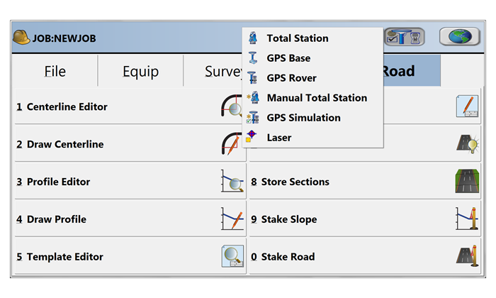
What features & menus are in Carlson SurvCE and SurvPC? (a running thread)
+SurvCE and SurvPC 5.xx


Features and Benefits of SurvCE and SurvPC 5.x
- Get the software that supports a wide variety of equipment, old or new.
- Enjoy excellent, free (and prompt) technical support
- Be heard – Carlson listens to its customers’ input for new features or drivers for all of its products
Carlson SurvCE is a complete data collection system for Real Time (RTK) GPS and Total Stations with in-field coordinate geometry. It supports the widest range of popular and new release RTK GPS and conventional/robotic total stations.
SurvCE and its full-windows companion SurvPC can be configured with various combinations of 4 modules: Total Station (Basic), Robotics (requires Basic), Carlson GPS and Advanced Roading (Requires Basic or other Carlson GPS).
Refer to this FAQ to see if your hardware is supported in SurvCE & SurvPC
Menus in SurvCE and SurvPC 5.x
File Menu
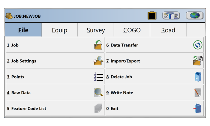
Equip Menu
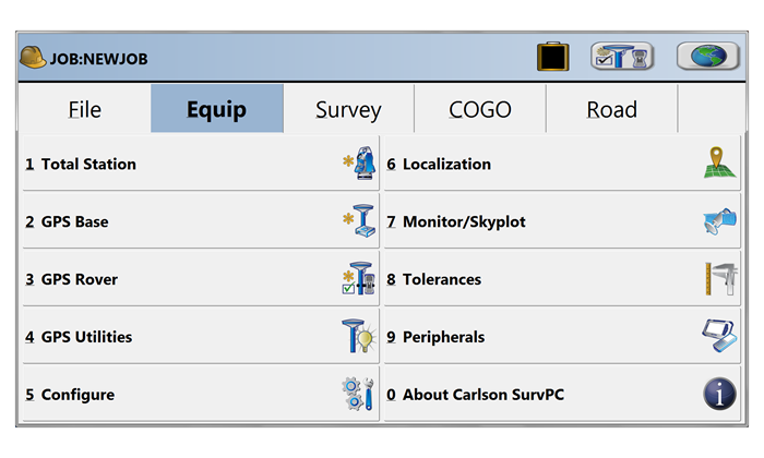
Survey Menu
COGO Menu
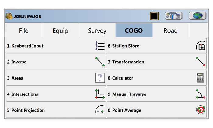
Road Menu

Select Equipment
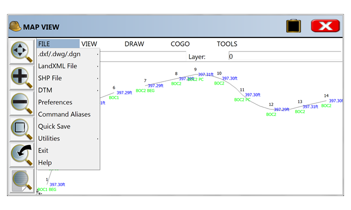
Map View | FILE Menu
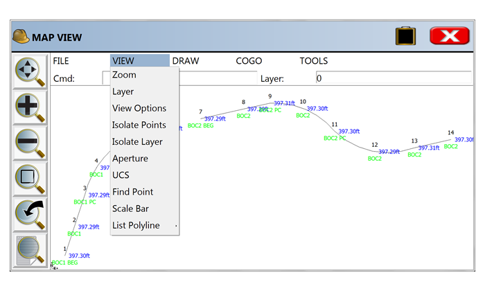
Map View | VIEW Menu
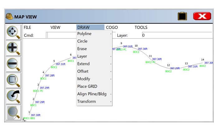
Map View | DRAW Menu
Map View | COGO Menu

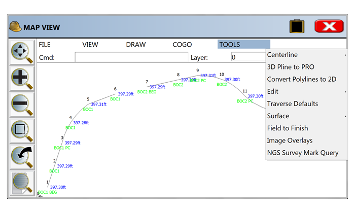
Map View | TOOLS Menu
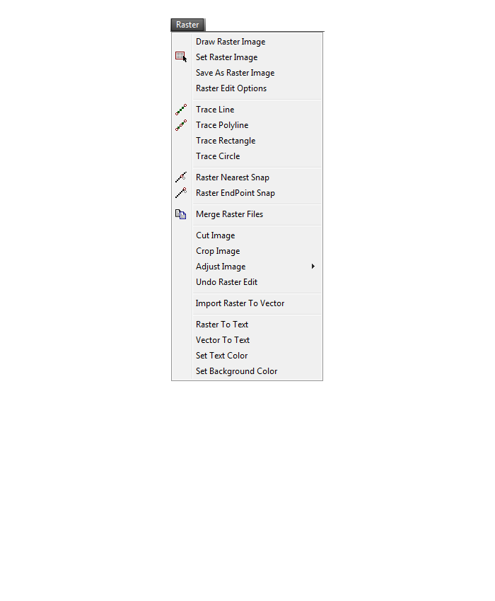
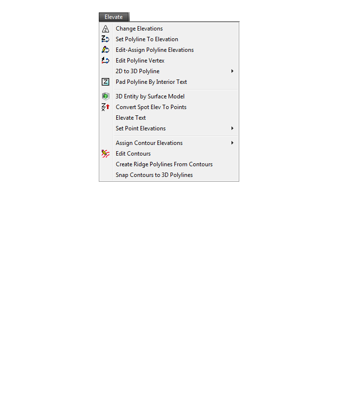
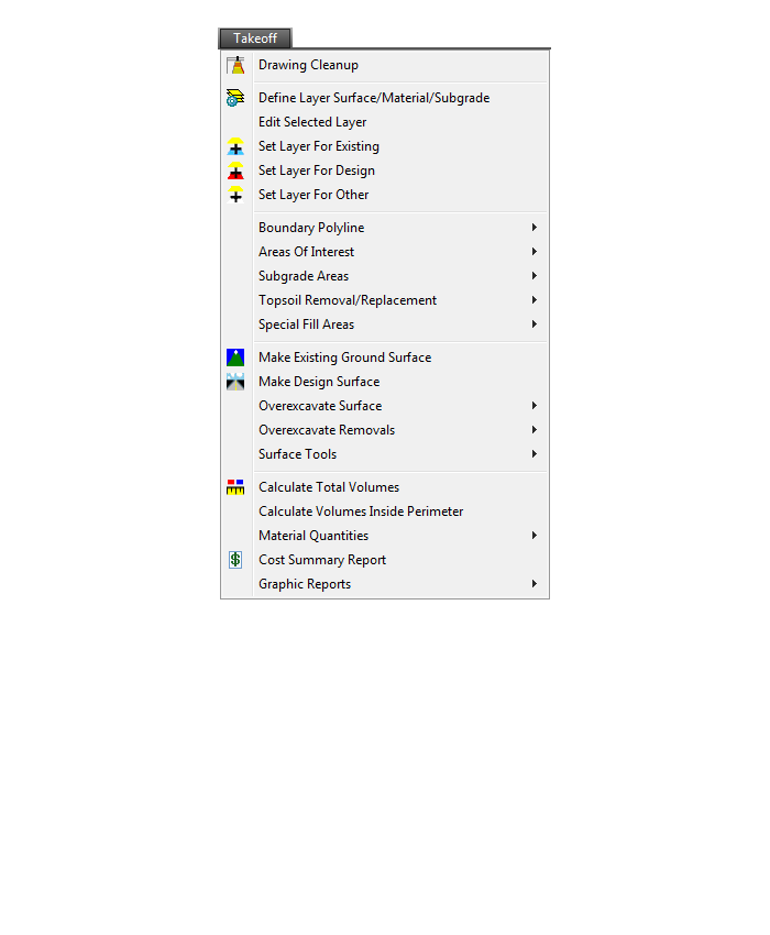
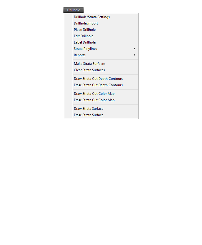
What features & menus are in Carlson Takeoff with embedded AutoCAD (OEM)? (a running thread)
+Takeoff 2017 (R9) with embedded AutoCAD (OEM)

Features and Benefits of Takeoff 2017 (R9) with embedded AutoCAD (OEM)
Key features include:
- Calculate site cut & fill and topsoil
- Differentiate strata volumes & dirt vs. rock
- Accurately determine subgrade quantities
- Estimate trench and pipe quantities
- Estimate roadways from cross-sections
- Prepare the design info for exact staking
- Create a 3D model for machine control
Menus in Takeoff 2017 (R9) with embedded AutoCAD (OEM)
Menu bar in Takeoff 2017 (R9)
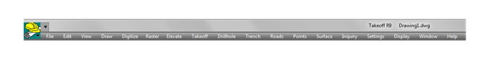
The menus below are available in Carlson Takeoff 2017 (R9) with embedded AutoCAD (OEM)
File Menu
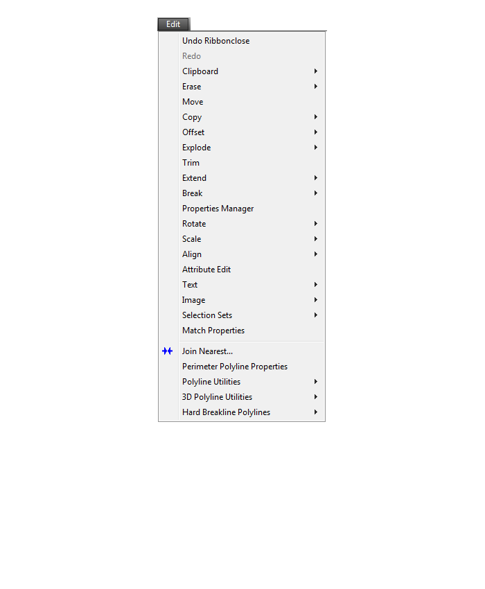
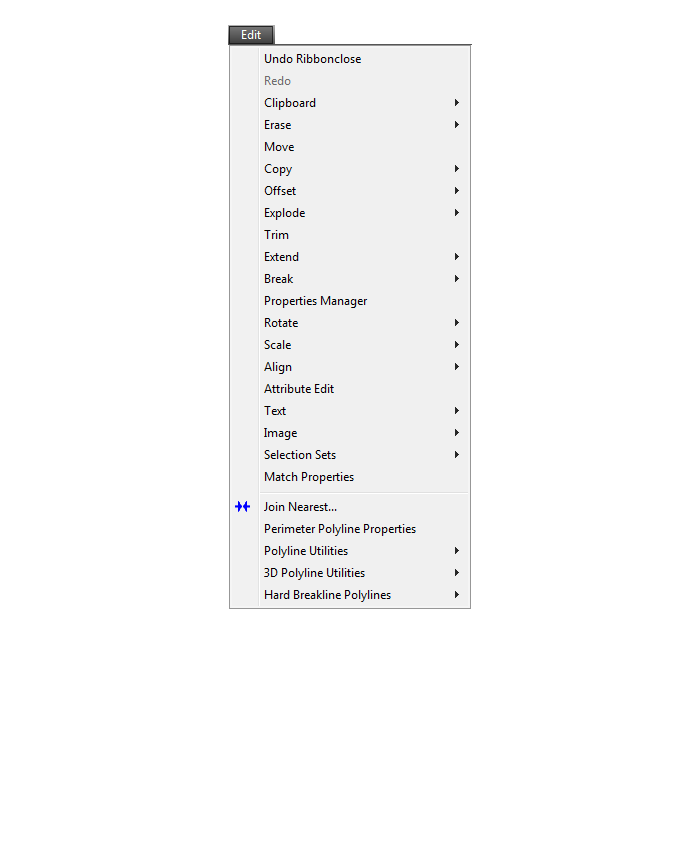
Edit Menu
View Menu

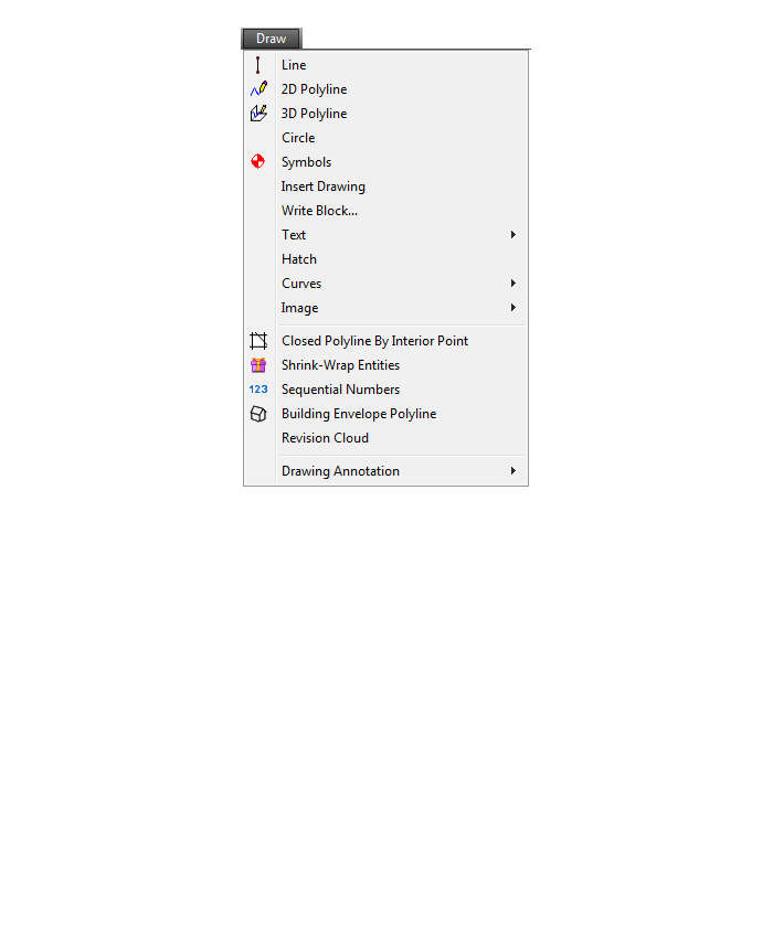
Draw Menu
Digitize Menu

Raster Menu
Elevate Menu
Takeoff Menu
Drillhole Menu
Trench Menu
Roads Menu

Points Menu
Surface Menu
Inquiry Menu
Settings Menu
Display Menu
Window Menu

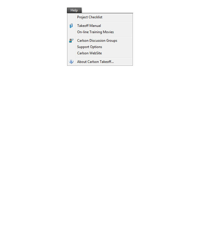
Help Menu
What features are in Carlson Precision 3D? (a running thread)
+Refer to this FAQ to see the latest improvements to Carlson’s desktop software products
Carlson Precision 3d Topo 2017
Features and Benefits of Precision 3D 2017
Carlson Precision 3D Topo’s editing ability of digital terrain models (DTMs) offers many benefits:
- Load and review the two most common formats for surfaces: LandXML and DXF files of 3D Faces, in addition to TIN and Grd files from Carlson Software.
- Overlay other LandXML file types such as points, alignments, parcels, storm and sanitary sewers, culvert pipes and other piping systems.
- View the 3D Surface with user-controlled textures to quickly spot errors in the DTM.
- Fix the errors in the DTM for re-saving and use in CAD programs, or for direct output for machine control and survey stakeout.
Never before has there been such an array of tools to locate and correct DTM errors, all in a sharp 3D interface. Surveyors, contractors and engineers alike can use the software to make sure the final DTM surface is of the highest quality. Editing tools include surface blending, spike and dimple removal, DTM vertex editing and surface pad placement by defined polygon and outslope conditions. Multiple undoes and redoes allow you to study your changes and makes things perfect.
That CAD Girl’s top reasons to purchase Carlson Software
+Click here to watch our Carlson Software: All Substance, No Styles webinar
for an overview of the program
1
You have options as to the platform: embedded AutoCAD (OEM), on top of full-AutoCAD or IntelliCAD
2
Carlson has Free Technical Support regardless of whether your software is 1 year or 10 years old or even if you’re still trying it out before buying.
3
Carlson gives you the ability to design dynamically but does it with basic CAD entities such as lines, polylines, text and blocks which makes it easy to share drawings with others.
No more proxy entities or AECC Objects to fight with!
4
Carlson doesn’t retire their products and never forces you to upgrade. Their annual maintenance is optional.
5
Carlson Plays Well With Others: Their goal is to have their software be compatible with as many other software and hardware manufacturers as possible. There is a seemingly endless list of “Import from…” and “Export to…” commands in the software.
6
Carlson gives you the tools you need.
The first 7 or 8 menus in all programs are identical and have all the basic tools you need to be more productive. Here are just some of the things you can do in every program:
| Work natively in DWG files and import/export DGN, DXF & DWF |
| Import and Export LandXML/RoadXML/Google Earth files |
| Full management and editing of point data including point groups and edit tracking |
| Esri-powered Search Published Control feature |
| Export files for many GPS-guided machine control systems |
| Customize project folders & sub-folders to organize project data |
| Drawing Cleanup |
| Join Nearest |
| Drawing Inspector |
| Layer Inspector |
| Shrinkwrap Entities |
| Twist Screen |
| 2D and 3D Polyline utilities such as reverse polyline, add/remove segments, add/remove vertices, daylight polyline to surface, etc |
| Layer Tools such as Erase and Copy by layer, Isolate, Restore |
| 3D Viewer Window |
| Surface 3D Viewer |
Does Carlson run on a Mac?
+What data collectors, GPS and total stations can I run with my Carlson SurvCE or SurvPC?
+
I’m a contractor and need to do takeoffs and create machine control files. What software do I need?
+The good thing about the Takeoff Suite is that you can buy the whole thing or just the pieces and parts you need. Many contractors only need the functionality of Construction and CADNet so, unless you need Trench and GeoTech as well, you could save a little money by just buying those modules. And you could always add the other pieces later if necessary.
Construction includes most of the functionality you will need for building models and doing takeoffs: tools for elevating 2D to 3D, site and roadway surface modeling (including resurfacing), quantity calcs, exporting to machine control and more.
CADNet includes the digitizing and imaging tools such as raster to vector, importing PDFs and BIM files and more.
GeoTech is for importing borehole data for analyzing subsurface conditions and materials.
Trench is for calculations related to installing pipes, sewers, or utility lines.
One other thing to note is that Construction is mostly a blend of the functionality you’ll find in Carlson Survey & Civil. Since the pricing of Civil Suite is the same as Construction, you may find that purchasing Civil Suite and CADNet is a good alternative to Construction and CADNet.
I’m a civil engineer. What software do I need?
+Since all three of these modules are included in the Carlson Civil Suite, that’s usually the better deal.
What versions of AutoCAD & IntelliCAD & Windows does Carlson run on top of? And what about AutoCAD LT? (a running thread)
+Carlson Desktop Software with IntelliCAD or for Your AutoCAD
Carlson can be installed on top of any full-AutoCAD-based program such as AutoCAD, AutoCAD Map, Land Desktop or Civil 3d. Carlson cannot be installed on top of any version AutoCAD LT.
| Carlson Version | AutoCAD & IntelliCAD Platforms | Windows Platforms |
|---|---|---|
| 2020 | AutoCAD 2015-2020, IntelliCAD 9.2 | 64 bit Windows 10 |
| 2019 | AutoCAD 2010-2019, IntelliCAD 9 | 32 or 64 bit Windows Vista, 7, 8, 8.1, and 10 |
| 2018 | AutoCAD 2010-2018, IntelliCAD 8.2 | 32 or 64 bit Windows Vista, 7, 8, 8.1, and 10 |
| 2017 | AutoCAD 2010-2017, IntelliCAD 8.2 | 32 or 64 bit Windows Vista, 7, 8, 8.1, and 10 |
| 2016 | AutoCAD 2007-2016, IntelliCAD 8.1 | 32 or 64 bit Windows Vista, 7, 8, 8.1, and 10 |
| 2015 | AutoCAD 2007-2015, IntelliCAD 8.0 | XP, 32 or 64 bit Windows Vista, 7, 8 and 8.1 |
| 2014 | AutoCAD 2004-2014, IntelliCAD 7.2 | XP, 32 or 64 bit Windows Vista, 7, 8 and 8.1 |
Carlson Desktop Software with Embedded AutoCAD (OEM)
| Carlson Version | Embedded AutoCAD Engine | Windows Platforms |
|---|---|---|
| Survey 2018/Takeoff R10 | 2018 | Windows 7, 8, 8.1, and 10 |
| Survey 2017/Takeoff R9 | 2013 | Windows XP, 7, 8, 8.1, and 10 |
| Survey 2016 | 2013 | Windows XP, 7, 8, 8.1, and 10 |
| Survey 2015/Takeoff R8 | 2013 | Windows XP, 7, 8, 8.1, and 10 |
| Survey 2014/Takeoff R7 | 2013 | Windows XP, 7, 8, 8.1, and 10 |
I’m a land surveyor. What software do I need?
+But, I find a lot of surveyors also need Carlson GIS for bringing in aerial photos, images of quad and soils maps.
And, this is a little out of the box, but if you’re a surveyor who does a lot of construction staking, I highly recommend Carlson Civil as well. Carlson Civil has a lot of tools that are meant to be used for design but, in my experience, can be invaluable for stakeout.
Most of these tools are in the 3D Data menu of Carlson Civil and include:
- 2D to 3D Polyline by Points and by Text with Leader
- Assign Contour Elevations
- Pad Polyline by Interior Text
- Draw Building Perimeter Polyline
- Convert Spot Elevations to Points
- Points by Slope
If you need Survey plus any of these other programs, you will have to use Carlson Survey with IntelliCAD or For Your AutoCAD because Survey and Takeoff are the only programs available on the embedded AutoCAD (OEM) platform.
And if you need Survey plus any of these other programs, you may want to consider the Civil Suite because the bundled pricing is often better than buying 2 or more individual modules.
Does Carlson have student or academic licenses?
+Carlson Software provides unlimited desktop licensing to qualified colleges and universities around the world.
What features & menus are in Carlson GeoTech? (a running thread)
+Refer to this FAQ to see the latest improvements to Carlson’s desktop software products
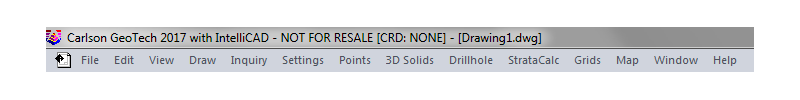
Carlson GeoTech 2017
Features and Benefits of GeoTech 2017
“GeoTech will model all core samples and produce a detailed, easy-to-read report for drill logs, cross sections, and plan view,” says Dave Carlson, V.P. of Development for Carlson Software.
In addition, this information is fully integrated with Carlson Civil, for determining site stability and suitability, and also Carlson Construction, for accurate strata takeoff estimation.
Menus in GeoTech 2017
Menu Bar in GeoTech 2017
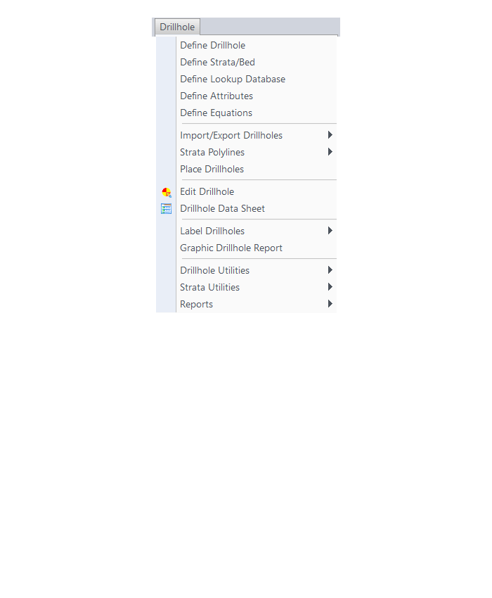
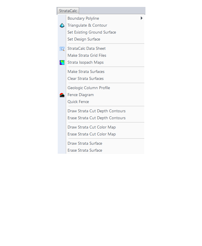
The menus below are available in Carlson GeoTech 2017
Drillhole Menu
StrataCalc Menu
Grids Menu
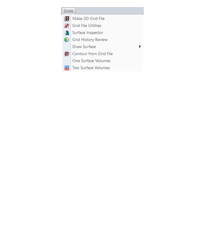
Map Menu
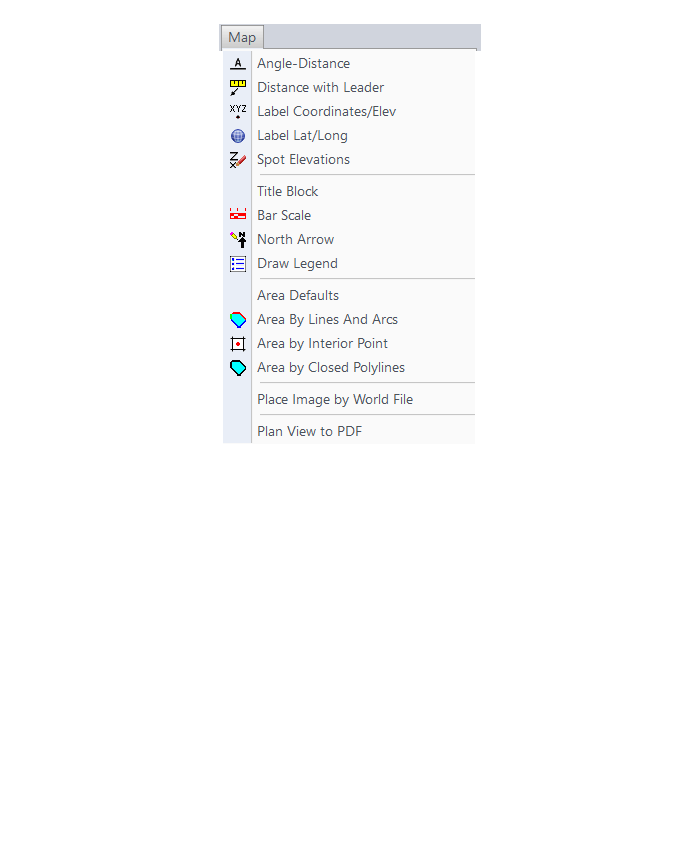
The menus below are in all non-OEM programs of Carlson 2017 desktop software
(Click image to see more)
Is embedded AutoCAD (OEM) more like AutoCAD or AutoCAD LT?
+Follow this FAQ to see a list of the differences between AutoCAD, Carlson’s IntelliCAD and the embedded AutoCAD (OEM) platforms.
Are Express Tools available in Carlson?
+Carlson Layer Tools are highlighted in the View menu below:
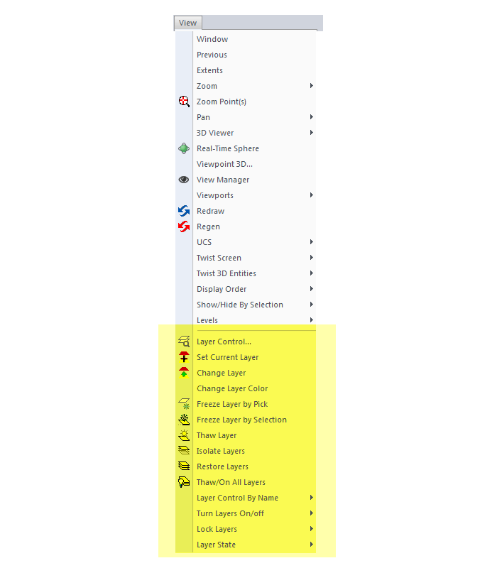
![]()
What are the system requirements to run Carlson SurvPC?
+Click here to review the minimum system requirements for SurvPC.
Is IntelliCAD more like AutoCAD or AutoCAD LT?
+Now, you also shouldn’t expect IntelliCAD to be the equivalent of today’s AutoCAD. IntelliCAD is a generic version of AutoCAD and will have the feel of an older “model” of AutoCAD and be missing some of the bells and whistles included in newer releases of AutoCAD.
But, it’s more customizable, supports LISP routines and 3D drafting.
Follow these links to see my FAQs that explain the differences between AutoCAD, Carlson’s IntelliCAD and the embedded AutoCAD (OEM) platforms.
You may also want to read this Software Review: AutoCAD and IntelliCAD that I wrote for Professional Surveyor Magazine several years ago.
If I use Carlson Survey in the office, do I have to use SurvCE on my data collector?
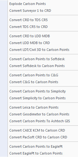
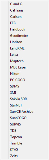
+Carlson Survey allows you to import, export and convert points and raw data from dozens of different formats and from a wide variety of manufacturers. Carlson Software, as a company, does everything within their power to make their software and hardware compatible with as many other manufacturers’ products as possible. Carlson wants their users to have the option of mixing and matching their software and equipment in a way that works best for their individual needs.
Here are just two examples of many throughout the program allowing you to import, export or convert external data.
The Convert Point Format menu:
The Import Raw File menu:
Compared to AutoCAD or IntelliCAD, what would I miss in the embedded AutoCAD (OEM) versions of Survey & Takeoff? (a running thread)
+Some AutoCAD commands, such as the Layer Tools that used to be in Express Tools and are now in the Layers II toolbar of AutoCAD, have been built into the Carlson menus. So even though you may not find the Layers II toolbar you can still freeze and isolate layers by picking entities on the screen.
I’ll keep this post as a running thread and will add to it as I come across functions or features you may miss.
- In OEM – Can’t load LSP files (verified in 2016). This is possible in AutoCAD and IntelliCAD.
- In OEM – Can’t change command aliases (acad.pgp) or Carlson QuickKeys (verified in 2016) – although you may find a workaround in this Carlson KB Article:Bits and Pieces. This is possible in AutoCAD and IntelliCAD.
- In OEM – The command REGEN is available but REGENALL is not (verified in 2016). This is possible in AutoCAD and IntelliCAD.
- In OEM – Carlson Startup Settings (aka Launch Options) such as setting a default template (.dwt) file are not available in the OEM (verified in 2016). This is possible in AutoCAD and IntelliCAD.
- In OEM and IntelliCAD – Express Tools aren’t available. However, you can use Carlson’s Layer Tools and Layer Toolbar as a workaround to replace the Express Tools Layers commands and the Layers II toolbar.